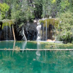
Connects: Glenwood Canyon, Hanging Lake Rest Area, Glenwood Canyon Trail, Dead Horse Creek, Dead Horse Trail, Hanging Lake (7,175 ft), Spouting Rock (7,323 ft) View Larger Map

Connects: Glenwood Canyon, Hanging Lake Rest Area, Glenwood Canyon Trail, Dead Horse Creek, Dead Horse Trail, Hanging Lake (7,175 ft), Spouting Rock (7,323 ft) View Larger Map
Connects: Woody Creek Road (CR 18), Kobey Park Road (FSR #508) Woody Creek, CO – Hard – 5.3 Miles – Hike, Run, Mountain Bike, Horseback Ride, Dog Friendly – Dirt Hannon Creek Trail is a difficult trail you can hike,…
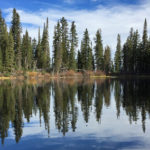
Connects: Hell Roaring Trail Old Snowmass, CO – Lake Hardscrabble Lake (10,140 ft) is a lake in the Maroon Bells-Snowmass Wilderness accessed by the Hell Roaring Trail near Old Snowmass, CO. Distances: Hell Roaring Trail (Old Snowmass Trailhead) to Hardscrabble…
Connects: Thompson Creek Road (CR 108), Westbank Trail, Hardwick Bridge, Old State Highway 82 (CR 154) Carbondale, Glenwood Springs, CO – Medium – 6.5 Miles – Road Bike – Paved Hardwick Bridge Road (CR 109), also known as Garfield County…
Connects: Burlingame Trail Aspen, CO – Park Harmony Park is an expansive area for playing at the Burlingame neighborhood in Aspen, CO. This park includes: Playground (Structures for Ages 2-5 and Ages 5-12) 2 Infant Swings 2 Child Swings Sandbox…
Connects: Burnt Mountain Road (FSR #506), Montgomery Flats Trail Thomasville, CO – Hut The Harry Gates Hut is a hut that is part of the 10th Mountain Division Hut System available for reservations through the 10th Mountain Division Hut Association.…
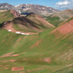
Connects: Four Pass Loop, West Maroon Trail, Hasley Pass (12,144 ft), Fravert Basin Trail Aspen, CO – Hard – 4.2 Miles – Hike, Run, Horseback Ride, Dog Friendly – Rocky/Dirt Hasley Basin Trail is a difficult trail you can hike,…
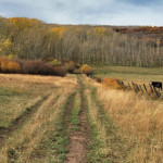
Connects: Mount Sopris Trail, Thomas Lakes Trail, Dinkle Lake Trail, Buzzard Basin Trail, Capitol Creek Road (CR 9) Old Snowmass, Basalt, Carbondale, CO – Medium – 7.4 Miles – Hike, Run, Mountain Bike, Horseback Ride, Dog Friendly – Dirt Hay…
Connects: American Lake Trail, Hayden Peak Ski Access Trail Aspen, CO – Mountain Peak Hayden Peak (13,561 ft) is a mountain peak in the Elk Mountains accessed by the American Lake Trail and Hayden Peak Ski Access Trail. News about…
Connects: Castle Creek Road, Hayden Peak (13,561 ft) Aspen, CO – Hard – 11 Miles – Uphill, Snowshoe, Classic XC Ski, Dog Friendly – Snow Hayden Peak Ski Access Trail is a difficult trail you can skin, snowshoe, and classic…
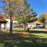
Connects: Railroad Ave Rifle, CO – Park Heinze Park is one of the oldest parks in Rifle, CO. This park includes: Playground Gazebo Horseshoe Pits View Larger Map
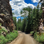
Connects: Hagerman Pass Road (FSR #105) Nast, CO – Viewing Area Hell Gate, also called Hell Gap, is a narrow section along Hagerman Pass Road (FSR #105) to Hell Gap where the valley drops far below and the road winds…