Lazy Glen Bridge

Connects: Rio Grande Trail Basalt, CO – Bridge The Lazy Glen Bridge is a bridge across the Roaring Fork River connecting the Lazy Glen neighborhood with the Rio Grande Trail near Basalt, CO. News about the Lazy Glen Bridge can

Posted in Basalt, Bridge, Sites

Lead King Basin Road (FSR #315)

Lead King Basin Road

Connects: Gunnison County Road 3, Daniels Hill, Lead King Loop, North Lost Trail, Silver Creek Trail, Schofield Pass Road (FSR #317), Crystal City Road (FSR #314), Avalanche Pass Trail Marble, CO – Hard – Hike, Run, Mountain Bike, Horseback Ride,

Posted in 4-7 Miles, Difficult, Dirt, Dog Friendly, Expert, Hard, Hiking, Horseback Riding, Marble, Mountain Biking, Rocky, Running, Sheep Mountain, Trails Tagged with: , , , ,

Lead King Loop

Lead King Loop

Connects: Aspen to Marble, Marble to Crested Butte, Daniels Hill, Lead King Basin Road (FSR #315), North Lost Trail, Avalanche Pass Trail, Arkansas Mountain Trail, Silver Creek Trail, Schofield Pass Road (FSR #317), Crystal City Road (FSR #314), Crystal City

Posted in 8-10+ Miles, Dirt, Dog Friendly, Hard, Hiking, Horseback Riding, Large Loops/Backpacking, Marble, More Than 10 Miles, Mountain Biking, Running, Sheep Mountain, Trails Tagged with: ,

Legend of Tall Tree Trail

Legend of Tall Tree Trail

Connects: Lizard Lake, Crystal City Road (FSR #314) Marble, CO – Hard – 0.30 Miles – Hike – Rocky/Dirt The Legend of Tall Tree Trail is a difficult unmarked trail you can hike. This is a short tough climb up

Posted in 1-3 Miles, Dirt, Hard, Hiking, Less Than A Mile, Marble, Rocky, Trails

Lems Shoes Boulder Boot

Lems Shoes Boulder Boot

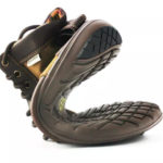
The Lems Shoes Boulder Boot is a minimalist shoe that is said to be the world’s most packable boot. It weighs 9.9 oz and can fold up like you’ve never seen a boot do. Pretty cool. __________ More Gear and

Posted in Blog, Footwear, Gear

Lenado Trail (Tincup/Tinpot Trail)

Lenado Trail

Connects: Arbaney Traverse, Four Corners (9,785 ft), Red Mountain Road (FSR 130.3), Secret Trail (Sunnyside Trail), Four Corners Road (20B.1), Van Horn Trail, Hobbit Trail, Lenado Aspen, Lenado, CO – Medium – 2.5 Miles – Hike, Run, Mountain Bike, Horseback

Posted in 1-3 Miles, 3 Miles, Aspen, Dirt, Dog Friendly, Hiking, Horseback Riding, Lenado, Medium, Moderate, Red Mountain Aspen, Rocky, Running, Trails Tagged with: , , ,

Leonard’s Lookout

Leonard’s Lookout

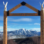
Connects: Sunlight Mountain, Grizzly Summer Road, Grizzly Ski Run, Garl’s Landing Glenwood Springs, CO – Viewing Area Leonard’s Lookout is a wooden structure with views of Mt. Sopris. This is a site along Grizzly Summer Road that follows Sunlight’s East

Posted in Memorial, Shrine, Sites, Sunlight Mountain Resort, Sunlight Mountain Resort, Viewing Area, Winter Site

Lift 1 Park

Lift 1 Park

Connects: Willoughby Park, Ski Lift No. 1 Aspen, CO – Park Lift 1 Park is an open area at the base of Aspen Mountain in Aspen, CO. This park includes: Ski Lift No. 1 Open Area View Larger Map

Posted in Aspen Parks, Dog Friendly, Parks

Light Hill

Light Hill

Connects: Basalt High School Trail, BLM Road 8334, BLM Road 8335, East Sopris Creek Road (CR 7) Old Snowmass, Basalt, CO – Medium – Distance Varies – Hike, Run, Mountain Bike, Dog Friendly – Dirt Light Hill, or the Light

Posted in 4-7 Miles, Basalt, Dog Friendly, Hiking, Medium, Moderate, Mountain Biking, Old Snowmass, Running, Trails

Lily Lake Trail

Connects: East Creek Trail, Placita Trail Redstone, CO – Hard – 10 Miles – Hike, Run, Horseback Ride, Dog Friendly – Dirt Lily Lake Trail #1964, also called Kline Creek Trail, is a difficult trail you can hike, run, and

Posted in 8-10+ Miles, Carbondale, Dirt, Dog Friendly, Hard, Hiking, Horseback Riding, Marble, More Than 10 Miles, Redstone, Running, Trails Tagged with:

Lily Pad Lake (11,147 ft)

Lily Pad Lake

Connects: Lily Pad Lake Trail, Ivanhoe Lake Road (FSR #527), Betty Bear Hut Nast, CO – Lake Lily Pad Lake (11,147 ft) is an alpine lake in the Upper Fryingpan Valley accessed by the Lily Pad Lake Trail near Nast,

Posted in Basalt, Lake, Meredith, Nast, Norrie, Sites, Thomasville

Lily Pad Lake Trail

Lily Pad Lake Trail

Connects: Fryingpan Lakes Road (FSR #505), Marten Creek Trail, Fryingpan Lakes Trail, Ivanhoe Lake Road (FSR #527), Betty Bear Hut, Lily Pad Lake (11,147 ft) Nast, CO – Medium – 2.5 Miles – Hike, Run, Dog Friendly – Dirt Lily

Posted in 1-3 Miles, 3 Miles, Basalt, Dirt, Dog Friendly, Hiking, Hunter-Fryingpan Wilderness, Leadville, Medium, Moderate, Nast, Norrie, Running, Trails

Lincoln Creek Grottos

Lincoln Creek Grottos

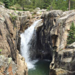
Connects: Lincoln Creek Road (FSR #106) Aspen, CO – Rocky Area The Lincoln Creek Grottos is a section of large rocks where water pools along Lincoln Creek off Lincoln Creek Road (FSR #106). Distances: Independence Pass Road (HWY 82)/Lincoln Creek

Posted in Aspen, Cave, Independence Pass, Rock, Sites Tagged with: ,

Lincoln Creek Road (FSR #106)

Connects: Independence Pass Road (HWY 82), Lincoln Gulch Campground, Lincoln Creek Grottos, New York Creek Trail, Tabor Creek Trail, Grizzly Reservoir, Grizzly Lake Trail, Lincoln Portal Campground, Truro Lake Trail, Petroleum & Anderson Lake Trail, Ruby Ghost Town Aspen, CO

Posted in 8-10+ Miles, Aspen, Dirt, Dog Friendly, Hiking, Horseback Riding, Independence Pass, Medium, Moderate, More Than 10 Miles, Mountain Biking, Rocky, Ruby, Running, Trails Tagged with: ,

Lindley Hut

Connects: Alfred A. Braun Hut System, Cooper Creek Road (CR 15C) Ashcroft, CO – Hut Lindley Hut is part of the Alfred A. Braun Hut System available for reservations through the 10th Mountain Division Hut Association. The hut is open

Posted in Alfred A. Braun Hut System, Ashcroft, Hut, Sites

Trail Search

Find a trail. Use 1 or all 4 drop downs to customize your search for the right trail.

Dog Friendly:

  or  

Park Search

Find a park. Use the drop downs to find the perfect park.

Dog Friendly:

  or  

Featured and Mentioned On

Questions? Email us at info@aspentrailfinder.com
By using this site you agree to the terms of our User Agreement. Read our Disclaimer.