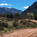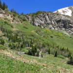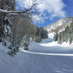
Aspen Mountain Uphill Route

Aspen Mountain Uphill Route

Connects: Silver Queen Gondola Aspen, CO – Hard – Uphill, Snowshoe – Snow Aspen Mountain Uphill Route is a difficult route you can skin and snowshoe up. Uphillers must turn around at 9 a.m., if they are not at the

Posted in 1-3 Miles, Aspen, Difficult, Hard, Skinning, Snow, Snowshoeing, Trails, Uphilling (SkiMo), Winter Trail

Aspen Night Sky Timelapse

This video has some of the best timelapse shots you’ll ever see of the Maroon Bells. Just pure Aspen night sky timelapse beauty here folks. Aspen, CO from Silent G Productions on Vimeo. __________ More Videos!

Posted in Blog, Promo, Timelapse, Video

Aspen Ski Hall of Fame Shrine

Aspen Ski Hall of Fame Shrine

Connects: Aspen Mountain, Blondie’s Ski Run Aspen, CO – Shrine The Aspen Ski Hall of Fame Shrine contains pictures of ski history and those involved in Aspen’s ski industry. The shrine is located near Blondie’s Ski Run on Aspen Mountain.

Posted in Aspen, Aspen Mountain (AJAX), Shrine, Sites

Aspen Summer Timelapse

A common thing you’ll hear in a person’s story about living in Aspen is they came to ski in the winter and stayed for the summer. This video is pure Aspen summer greatness. Aspen Timelapse from Jason Dewey Productions on

Posted in Blog, Promo, Timelapse, Video

Aspen Timelapses from The Art of Flight

Here are some short timelapses from The Art of Flight. The night snowcat shot with the spaceship audio completely rocks. The Art of Flight – Aspen Timelapses from BrainFarm on Vimeo. __________ More Videos!

Posted in Blog, Promo, Timelapse, Video

Aspen to Crested Butte

Aspen to Crested Butte

Connects: Maroon Creek Road (CR 13), Maroon Creek Trail, Maroon Lake (9,585 ft), Maroon Bells Scenic Trail, Four Pass Loop, Crater Lake Trail, Crater Lake (10,076 ft), West Maroon Trail, West Maroon Pass (12,465 ft), East Maroon Trail, East Maroon

Posted in 8-10+ Miles, Aspen, Crested Butte, Difficult, Dirt, Dog Friendly, Gothic, Hard, Hiking, Horseback Riding, Large Loops/Backpacking, Maroon Bells-Snowmass Wilderness, More Than 10 Miles, Mountain Biking, Rocky, Running, Trails Tagged with:

Aspen to Marble

Aspen to Marble

Connects: Marble to Crested Butte, Four Pass Loop, Maroon Lake (9,585 ft), Buckskin Pass (12,462 ft), Snowmass Lake (10,980 ft), Trail Rider Pass (12,415 ft), Geneva Lake (10,940 ft), Lead King Loop, Beaver Lake (7,945 ft) Aspen, Marble, CO –

Posted in 8-10+ Miles, Aspen, Difficult, Dirt, Dog Friendly, Hard, Hiking, Horseback Riding, Large Loops/Backpacking, Marble, More Than 10 Miles, Running, Trails

Aspen Valley Ranch Trail

Aspen Valley Ranch Trail

Connects: Upper River Road (CR 17), Red Canyon Trail Aspen, CO – Medium – 1.75 Miles – Hike, Run, Mountain Bike, Horseback Ride, Dog Friendly – Dirt Aspen Valley Ranch Trail is an intermediate/moderate trail you can hike, run, mountain

Posted in 1-3 Miles, Aspen, Dirt, Dog Friendly, Hiking, Horseback Riding, Medium, Moderate, Mountain Biking, Running, Trails, Woody Creek

Aspen/Norrie Trail

Aspen/Norrie

Connects: Twin Meadows (9,465 ft), Sawmill Park, Spruce Creek Trail Norrie, CO – Medium – 4.5 Miles – Hike, Run, Horseback Ride, Dog Friendly – Dirt Aspen/Norrie Trail #1927, also called the Norrie Trail, is an intermediate/moderate trail you can

Posted in 4 Miles, 4-7 Miles, Basalt, Dirt, Dog Friendly, Hiking, Horseback Riding, Hunter-Fryingpan Wilderness, Medium, Meredith, Moderate, Ruedi Reservoir, Running, Trails Tagged with: ,

Atkinson Canal Trail

Atkinson Canal Trail

Connects: Three Mile Park Glenwood Springs, CO – Easy – 1.4 Miles – Walk, Run, Road Bike, Dog Friendly – Paved Atkinson Canal Trail is an easy trail you can walk, run, and bike that is dog friendly. This is

Posted in 1-3 Miles, 2 Miles, Dog Friendly, Easy, Glenwood Springs, Paved, Road Biking, Running, Trails, Walking

Avalanche Creek Road (FSR #310)

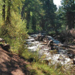
Avalanche Creek Road

Connects: Highway 133 (West Elk Loop Scenic Byway), Janeway Trail, Janeway Campground, Bulldog Creek Trail, Avalanche Campground, Avalanche Creek Trail View Larger Map
Posted in 1-3 Miles, 2 Miles, Carbondale, Classic XC Skiing, Dirt, Dog Friendly, Hiking, Horseback Riding, Medium, Moderate, Mountain Biking, Nordic (XC Ski), Running, Snow, Snowshoeing, Trails

Avalanche Creek Trail

Avalanche Creek Trail

Connects: Avalanche Creek Road (FSR #310), Avalanche Campground, Hell Roaring Trail, Duley Park, East Creek/Gift Creek Trail, Capitol Creek Trail, Silver Creek Trail, Avalanche Lake (10,695 ft) Carbondale, CO – Medium – 11 Miles – Hike, Run, Horseback Ride, Dog

Posted in 8-10+ Miles, Carbondale, Dirt, Dog Friendly, Hiking, Horseback Riding, Marble, Maroon Bells-Snowmass Wilderness, Medium, Moderate, More Than 10 Miles, Running Tagged with:

Avalanche Pass (12,100 ft)

Avalanche Pass Trail

Connects: Avalanche Pass Trail Marble, CO – Mountain Pass Avalanche Pass (12,100 ft) is a high mountain pass accessed along the Avalanche Pass Trail in the Maroon Bells-Snowmass Wilderness near Marble, CO. View Larger Map

Posted in Marble, Maroon Bells-Snowmass Wilderness, Mountain Pass, Sites

Avalanche Pass Trail

Avalanche Pass Trail

Connects: Lead King Loop, Lead King Basin Road (FSR #315), North Lost Trail, Carbonate Creek Trail, Buckskin Basin, Avalanche Pass (12,100 ft) Marble, CO – Hard – 3.7 Miles – Hike, Run, Horseback Ride, Dog Friendly – Dirt Avalanche Pass

Posted in 1-3 Miles, 3 Miles, Carbondale, Difficult, Dirt, Dog Friendly, Hard, Hiking, Horseback Riding, Maroon Bells-Snowmass Wilderness, Running, Trails

Axtell Park

Axtell Park

Glenwood Springs, CO – Park Axtell Park is an area in Glenwood Springs, CO. This park includes: a playground, picnic tables, a barbecue grill, and restrooms. View Larger Map

Posted in Barbecue Grill, Bench, Dog Friendly, Glenwood Springs Parks, Parks, Picnic Table, Playground, Restroom

Trail Search

Find a trail. Use 1 or all 4 drop downs to customize your search for the right trail.

Dog Friendly:

  or  

Park Search

Find a park. Use the drop downs to find the perfect park.

Dog Friendly:

  or  

Featured and Mentioned On

Questions? Email us at info@aspentrailfinder.com
By using this site you agree to the terms of our User Agreement. Read our Disclaimer.