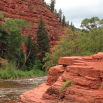
Connects: Fryingpan River, Frying Pan Road (CR 104), Old Wagon Road, Toner Creek Road Basalt, CO – Rock Strawberry Rock is a rock on the Fryingpan River with a short dirt path to the big rock. This is a site…
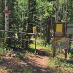
Connects: Buttermilk Summer Road, Buttermilk Trail, West Buttermilk Warming Hut, West Buttermilk Trail, Government Trail Aspen, CO – Hard – 1.7 Miles – Hike, Run, Mountain Bike, Dog Friendly – Dirt The Sugar Bowls Trail is a difficult trail you…
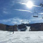
Glenwood Springs, CO – Hard – 1.5 Miles – Uphill, Snowshoe – Snow Sun King Uphill Route is a difficult route you can skin and snowshoe up. This is a 1.5 mile uphill route on Sunlight Mountain in Glenwood Springs,…
Connects: Babbish Trail, Babbish Express Trail, Compass Peak (9,895 ft), Compass Trail, Dippsy Doodle Trail, Garl’s Landing, Glades Trail, Grizzly Summer Road, High Places Chapel, Holiday Hill Trail, Leonard’s Lookout, Little Beaver Trail, Old Four Mile Road, Sun King Uphill…
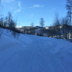
Connects: Marion Cemetery Road (CR 123), Marion Cemetery, Marion Gulch Trail, Sunlight Mountain, Four Mile Road (FSR #300), Powderhorn Mountain Carbondale, Glenwood Springs, Grand Junction, CO – 120 Miles – Difficulty Varies – Snowshoe, Classic XC Ski – Snow The…
Connects: Lower Sunshine Trail, Tenderfoot Trail, Old Four Mile Road, Sunlight Backcountry Cabin, Williams Trail, Babbish Trail Glenwood Springs, CO – Easy – Snowshoe, Classic XC Ski, Dog Friendly – Snow Sunshine Trail is an easy winter trail you can…
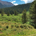
Connects: Lincoln Creek Road (FSR #106), Tabor Lake (12,310 ft) Aspen, CO – Medium – 3.9 Miles – Hike, Run, Horseback Ride, Dog Friendly – Dirt Tabor Creek Trail #2185, also called the Tabor Lake Trail, is an intermediate/moderate difficulty…
Connects: Tabor Creek Trail Aspen, CO – Lake Tabor Lake (12,310 ft) is an alpine lake accessed by the Tabor Creek Trail in the Collegiate Peaks Wilderness near Aspen, CO. More information about Tabor Lake can be found at: White…