Tiehack Summer Road

Tiehack Summer Road

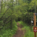
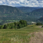
Connects: Terral Wade Bridge (Tiehack Nordic Bridge), Tiehack Trail, Oregon Trail, Government Trail, Buttermilk Summer Road, Buttermilk Trail Aspen, CO – Hard – 2.75 Miles – Hike, Run, Mountain Bike, Dog Friendly – Dirt The Tiehack Summer Road is a

Posted in 1-3 Miles, 3 Miles, Aspen, Buttermilk Mountain, Difficult, Dirt, Dog Friendly, Hard, Hiking, Mountain Biking, Running, Trails

Tiehack Trail

Tiehack Uphill Route

Connects: Terral Wade Bridge (Tiehack Nordic Bridge), Tiehack Summer Road, Oregon Trail, Government Trail, Buttermilk Summer Road Aspen, CO – Hard – 1.5 Miles – Hike, Run, Dog Friendly – Dirt The Tiehack Trail is a difficult trail you can

Posted in 1-3 Miles, 2 Miles, Aspen, Buttermilk Mountain, Difficult, Dirt, Dog Friendly, Hard, Hiking, Running, Trails

Tiehack Uphill Route

Tiehack Uphill Route

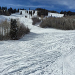
Connects: Terral Wade Bridge (Tiehack Nordic Bridge), Tiehack Warming Hut, Tiehack Express Lift, Summit Express Lift, West Buttermilk Warming Hut Aspen, CO – Hard – 1.75 Miles – Uphill, Snowshoe – Snow The Tiehack Uphill Route is a difficult route

Posted in 1-3 Miles, Aspen, Buttermilk Mountain, Hard, Skinning, Snow, Snowshoeing, Trails, Uphilling (SkiMo), Winter Trail

Tiehack Warming Hut

Tiehack Warming Hut

Connects: Tiehack Express Lift, Tiehack Uphill Route, Owl Creek Trail (Winter) Aspen, CO – Hut The Tiehack Warming Hut is a structure with restrooms at the bottom of the Tiehack Express Lift on Buttermilk Mountain in Aspen, CO. View Larger

Posted in Aspen, Buttermilk Mountain, Hut, Sites

Tierney Mercantile Store

Tierney Mercantile Store

Connects: Basalt History Tour Basalt, CO – Historic The Tierney Mercantile Store, also called the Sloss Store and American Legion Building, is an old building on West Homestead Drive that is part of the Basalt History Tour in Basalt, CO.

Posted in Basalt, Historic, Sites, Structure Tagged with: ,

Toilet Bowl

Connects: Ruedi Reservoir, Fryingpan River, Frying Pan Road (CR 104) Basalt, CO – Water The Toilet Bowl is a popular fishing spot below Ruedi Dam on the Fryingpan River. People are allowed to fish from the shore, however, no one

Posted in Recreation Area, Sites, Water

Tom Blake Equestrian Trail

Tom Blake Equestrian Trail

Connects: Highline Trail, Tom Blake Trail, Owl Creek Trail, Anaerobic Nightmare Trail, Sequel Trail, Terminator Trail (Winter) View Larger Map
Posted in 1-3 Miles, 2 Miles, Classic XC Skiing, Dirt, Dog Friendly, Hiking, Horseback Riding, Medium, Moderate, Nordic (XC Ski), Running, Skate Skiing, Snow, Snowmass Village, Snowshoeing, Trails, Winter Trail Tagged with: ,

Tom Blake Trail

Tom Blake Trail

Connects: Snowmass Loop, Highline Trail, Tom Blake Equestrian Trail, Owl Creek Trail, Anaerobic Nightmare Trail, Sequel Trail, Stark’s Trail, Powerline Trail, Snowmass Bike Park, Vista Trail View Larger Map
Posted in 1-3 Miles, 4 Miles, Classic XC Skiing, Dog Friendly, Hiking, Medium, Moderate, Mountain Biking, Nordic (XC Ski), Running, Snow, Snowmass Village, Snowshoeing, Trails Tagged with: ,

Toner Creek Road

Toner Creek Road

Connects: Frying Pan Road (CR 104), Strawberry Rock, Old Wagon Road Basalt, CO – Medium – 2 Miles – Hike, Run – Dirt Toner Creek Road, also referred to as Toner Trail, is an intermediate/moderate trail you can hike and

Posted in 1-3 Miles, 2 Miles, Basalt, Basalt State Wildlife Area, Dirt, Gravel, Hiking, Medium, Moderate, Running, Trails Tagged with:

Tootsie Roll Trail

Tootsie Roll Trail

Connects: Smuggler Mountain, Smuggler Mountain Road (FSR #131), Lollipop Trail Aspen, CO – Medium – 1.06 Miles – Hike, Run, Mountain Bike, Dog Friendly – Dirt Tootsie Roll Trail is an intermediate/moderate trail you can hike, run and mountain bike

Posted in 1 Mile, 1-3 Miles, Aspen, Dirt, Dog Friendly, Hiking, Medium, Moderate, Mountain Biking, Running, Smuggler Mountain, Trails

Tot Lot Park

Tot Lot Park

Connects: Cemetery Lane, Alta Vista Drive, Aspen Golf Course, Cemetery Lane Trail, Red Butte Cemetery Aspen, CO – Park Tot Lot Park is an open area bordering the Aspen Golf Course off the Cemetery Lane Trail and Alta Vista Drive

Posted in Aspen Parks, Basketball Court, Dog Friendly, Open Area, Parks, Picnic Table, Playground

Tourtolotte Park

Connects: Aspen Mountain Ski Area Aspen, CO – Historic Tourtolotte Park is an old mining town, now an open area below Buckhorn Ski Run, on Aspen Mountain in Aspen, CO. More information about Tourtolotte Park can be found at: The

Posted in Aspen, Aspen Mountain (AJAX), Ghost Town, Historic, Sites

Town Park

Town Park

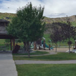
Connects: Snowmass Loop, Brush Creek Trail, Rodeo Park, Snowmass Skate Park Snowmass Village, CO – Park Town Park, also called Community Park, is an open area near the Town Park Station in Snowmass Village, CO. This park includes: Playground (Ages

Posted in Gazebo/Shelter, Parks, Picnic Table, Playground, Snowmass Village Parks Tagged with:

Trail Rider Pass (12,415 ft)

Trail Rider Pass

Connects: Four Pass Loop, Aspen to Marble, Geneva Lake Trail Snowmass, CO – Mountain Pass Trail Rider Pass (12,415 ft) is one of four passes along the Four Pass Loop accessed along the Geneva Lake Trail. This is a mountain

Posted in Maroon Bells-Snowmass Wilderness, Mountain Pass, Sites Tagged with:

Trail Roulette

We just put the finishing touches on our new favorite feature, a random trail generator button! Holy smokes, prepare for random adventure. It’s super simple. Click the button and you’ll be taken to a random trail. It’s trail roulette! Click,

Posted in About, Blog Tagged with:

Trail Search

Find a trail. Use 1 or all 4 drop downs to customize your search for the right trail.

Dog Friendly:

  or  

Park Search

Find a park. Use the drop downs to find the perfect park.

Dog Friendly:

  or  

Featured and Mentioned On

Questions? Email us at info@aspentrailfinder.com
By using this site you agree to the terms of our User Agreement. Read our Disclaimer.