Connects: Basalt Chamber of Commerce Caboose, Codgers Corner, Alpine Bank / Basalt Building, Centennial Sculpture, Frying Pan Inn/Colorado Midland Hotel, Swinging Bridge, Arbaney Barn, Arbaney Residence, Frying Pan Coke Ovens, Arbaney Park, Berm Trail, Luchsinger Halfway House, Pueblo Bridge, Basalt Community Methodist Church, Independent Order of Odd Fellows, Tierney Mercantile Store, Putman House, W.W. Frey Building, Kelly Building, The Little Snell Building, Basalt Lions Park

The Basalt History Tour in Downtown Basalt
Basalt, CO – Easy – Walk, Dog Friendly – Less Than A Mile – Paved
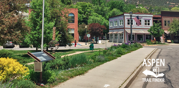
The Basalt History Tour, also called the Basalt Historical Walking Tour, is a walk around the Town of Basalt to 12 informational signs featuring the history of the town. This less than a mile walk follows white bear paw prints on the sidewalk. This a history tour in Basalt, CO.
News about the Basalt History Tour can be found at:
The Aspen Times (December 26, 2017) – Historic Kelly Block building sells, starts new chapter in Basalt
The Aspen Times (June 5, 2014) – Basalt walking tour showcases rich history, modern beauty
More information about the Basalt History Tour can be found at:
Basalt Regional Heritage Society – Basalt Historical Walking Tour
“Basalt was formed in the late 1800s. Settlement of the West was influenced by many factors: miners looking for precious metals; ranchers providing meat, grains and vegetables; and the railroads, which served both. Railroads became the lifelines that carried the ore, supplies and people. All combined to form the town we now call Basalt.
The first settlement, built in 1882, was a tent city called Fryingpan on the south side of the Frying Pan River. It was created to house the men working the charcoal kilns which remain today and which you will see later on this tour. By 1886 the little community of Aspen Junction on the site of present Basalt began to form with the requisite “boarding house, general store and 7 saloons.” The town was a railroad camp housing crews needed for the construction of the Colorado Midland Railroad.
Begun in May 1885, the Colorado Midland Railroad was constructed in three directions: to Aspen, to Glenwood and down the Frying Pan from Leadville. In the incredibly short time of 18 months, the railroad was completed from Hagerman Pass to Aspen Junction. In that 18 months, cliffs were cut back, bridges were built, roads were leveled and track was laid for over 60 miles. In November 1887, service began. The routes followed what are now the two main streets of Basalt, up Midland along the Frying Pan River Road, and paralleling the Roaring Fork River at the location of original Highway 82, now Two Rivers Road. Simultaneously, the Denver and Rio Grande Railroad was building its line from Glenwood to Aspen and operated its first trail in the same year. The route was located on what is now the popular Rio Grande bike trail between Glenwood and Aspen. In 1894 the name of Aspen Junction was changed to Basalt to clarify where the mail should go; not to Grand Junction and not to Aspen.
During its early history, Basalt was a thriving railroad center that later shrank with the closing of the railroad in 1919. From the 1920s to the 1960s, Basalt was a ranching community and a bedroom community, supporting the great growth of the ski areas up-valley. Today, Basalt is a community of its own with a strong base of fishing and tourism.
We hope you will enjoy the tour you are about to begin. The signs will provide history and photos of important elements of Basalt’s early years and take you through some of our hidden joys. Orient yourself by looking at the rivers and the mountains in the photos. The tour is an enjoyable, level walk and takes about 45 minutes. To take the tour, just follow the white footsteps. Enjoy!”
Although we take our bridges fro granted today, in the 1800s they were a crucial lifeline for commerce and travel, and the untamed rivers often washed them away in the high water of the spring.
In the mid-1800s, the townspeople determined that the bridge crossing the Frying Pan at the location of the swinging bridge, just downstream, was inadequate. They then rerouted the main road and constructed a wood and metal bridge at this site (*Pueblo Bridge) In 1908 that bridge was replaced with a concrete and steel “Pueblo Bridge,” named after the company that produced the bridge and sold them to various Colorado communities. The bridge stands here today.
Then in 1937 the Colorado Highway Department acquired the original railroad bridge, where it crosses the Frying Pan just above its junction with the Roaring Fork, and converted it to a highway automobile bridge as part of “old” Highway 82. Highway 82 became the main route for traffic up and down the valley, and until Basalt began expanding in the 1970s, the Pueblo Bridge received little use.
In the high water year of 1957, the two-part bridge crossing the Roaring Fork, shown in the photo, became precarious to traverse. School busses were unloaded, kids walked across, and the buses then drove over empty, reloaded and continued their rounds. This bridge is at the identical site of the current pedestrian bridge at Basalt Avenue.”


