Redstone Pillar

Redstone Pillar

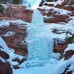
Connects: Redstone Castle Redstone, CO – Ice The Redstone Pillar is a single pitch of pure ice used for ice climbing. This is an ice formation found during winter in Redstone, CO. Access to the Redstone Pillar is not well

Posted in 1 Mile, 1-3 Miles, Climbing, Hard, Ice, Redstone, Sites, Snowshoeing, Winter Trail

Redstone River Boulders

Redstone River Boulders

Connects: Highway 133 (West Elk Loop Scenic Byway), Crystal River, Redstone Campground Redstone, CO – Rocky Area The Redstone River Boulders offer climbing with access to the Crystal River. This is a site where various boulders sit off Highway 133

Posted in Carbondale, Climbing, Redstone, Rock, Sites, Water

Rifle Arch (6,580 ft)

Rifle Arch

Connects: Rifle Arch Trail Rifle, CO – Rock Rifle Arch (6,580 ft) is a 60 foot high, 150 foot wide stone arch that rises off the Grand Hogback accessed by the Rifle Arch Trail in Rifle, CO. News about Rifle

Posted in Rifle, Rock, Sites, Viewing Area

Rifle Boat Ramp

Rifle Boat Ramp

Connects: Colorado River, Colorado River Trail Rifle, CO – Recreation Area The Rifle Boat Ramp is a boat put in and trail network along the Colorado River in Rifle, CO. In 2016, the boat ramp was moved to be located

Posted in Recreation Area, Rifle, Rifle Parks, Sites, Water

Rifle Bridge

Rifle Bridge

Connects: Colorado River Rifle, CO – Bridge The Rifle Bridge is a historic bridge built in 1909. This bridge is listed on the National Register of Historic Places. A sign on the bridge reads, “Bridge closed to all traffic trespassers

Posted in Bridge, Historic, Rifle, Sites

Rifle Disposal Site

Connects: Government Road (CR 13), Estes Gulch, Hogback Ridge Trail Rifle, CO – Historic The Rifle Disposal Site is a 71-acre radioactive tailings disposal mound built by the Department of Energy for the interment of 3.5 million cubic yards of

Posted in Historic, Rifle, Sites Tagged with:

Rifle Falls (6,550 ft)

Rifle Falls

Connects: Rifle Falls State Park, Coyote Trail, Mountain Mist Amphitheater, Rifle Falls Caves, Bobcat Trail, Squirrel Trail Rifle, CO – Waterfall Rifle Falls (6,550 ft) is a 70-foot triple waterfall flowing over a dam on East Rifle Creek in Rifle

Posted in 1-3 Miles, Dirt, Dog Friendly, Easy, Hiking, Rifle, Rifle Falls State Park, Running, Sites, Snow, Walking, Waterfall

Rifle Falls Caves

Rifle Falls Caves

Connects: Rifle Falls State Park, Rifle Falls, Coyote Trail, Bobcat Trail Rifle, CO – Caves The Rifle Falls Caves are two limestone caves in the Rifle Falls State Park. Both caves are located a short distance from Rifle Falls off

Posted in Cave, Rifle, Rifle Falls State Park, Sites

Rifle Falls State Park

Rifle Falls

Connects: Highway 325, Rifle Falls (6,550 ft), Squirrel Trail, Coyote Trail, Mountain Mist Amphitheater, Bobcat Trail, Cascades (Rifle), Rifle Falls State Fish Hatchery Rifle, CO – Recreation Area Rifle Falls State Park is a 48-acre park located 13 miles off

Posted in Barbecue Grill, Bench, Cave, Dirt, Dog Friendly, Dog Friendly, Easy, Gazebo/Shelter, Hiking, Medium, Moderate, Open Area, Parks, Paved, Picnic Table, Pond, Rifle, Rifle Falls State Park, Running, Sites, Snow, Stream, Walking

Rifle Gap

Rifle Gap

Connects: Highway 325, Rifle Gap State Park, Lakeview Campground, Cedar Campground, Pinyon Campground, Sage Campground Rifle, CO – Rock Rifle Gap is a narrow pass through the Grand Hogback that goes to Rifle Gap State Park located 10 miles off

Posted in Recreation Area, Rifle, Rock, Sites, State Park

Rifle Gap State Park

Rifle Gap Reservoir

Connects: Highway 325, Rifle Gap, Rifle Gap Reservoir, Lakeview Campground, Cedar Campground, Pinyon Campground, Sage Campground Rifle, CO – Recreation Area Rifle Gap State Park is a 350-acre reservoir that provides boating, fishing, and swimming located 10 miles off I-70

Posted in Campground, Recreation Area, Rifle, Sites, State Park

Rifle Mountain Park

Rifle Mountain Park

Connects: Rifle Creek Road (CR 217), Koper’s Trail, Lower Ice Cave, Upper Ice Cave Rifle, CO – Recreation Area To get to the park from downtown Rifle, take Railroad Avenue (which becomes Highway 13) north through the city. Take a

Posted in Recreation Area, Rifle, Rifle Mountain Park, Sites

Rio Grande ARTway

Rio Grande ARTway

Connects: Rio Grande Trail, Derail Park, Crystal Valley Trail, Highway 133 (West Elk Loop Scenic Byway) Carbondale, CO – Art The Rio Grande ARTway is a 1 mile section along the Rio Grande Trail in Carbondale designed to showcase the

Posted in 1 Mile, 1-3 Miles, Art, Carbondale, Decoration, Dirt, Dog Friendly, Easy, Gravel, Hiking, Mountain Biking, Paved, Road Biking, Running, Sites, Trails, Walking

Rio Grande Trail

Rio Grande Trail

Connects: No Problem Joe Trail, Herron Park, Newbury Park, Oklahoma Flats Trail, Rio Grande Park, John Denver Sanctuary, Sheely Bridge (Ron Krajian Bridge), Red Mountain Road (CR 20), Hunter Creek Trail, Grindlay Bridge, Music Tent Trail, Meadows Trail, Meadows Bridge,

Posted in 8-10+ Miles, Aspen, Aspen/Snowmass Nordic Trail System, Basalt, Carbondale, Classic XC Skiing, Dog Friendly, Easy, Fat Biking, Glenwood Springs, Gravel, Hiking, Horseback Riding, More Than 10 Miles, Mountain Biking, Nordic (XC Ski), Paved, Road Biking, Running, Skate Skiing, Snow, Snowshoeing, Trails, Walking, Winter Site, Winter Trail, Woody Creek Tagged with: , , , ,

Roaring Fork Gorge

Connects: Roaring Fork River River, Slaughterhouse Bridge (Cemetery Lane Bridge), Rio Grande Trail, Stein Park, Gold Butte, Stein Bridge, Jaffee Park Aspen, CO – Water The Roaring Fork Gorge is a stretch along the Rio Grande Trail in the Roaring

Posted in Aspen, Sites, Water

Trail Search

Find a trail. Use 1 or all 4 drop downs to customize your search for the right trail.

Dog Friendly:

  or  

Park Search

Find a park. Use the drop downs to find the perfect park.

Dog Friendly:

  or  

Featured and Mentioned On

Questions? Email us at info@aspentrailfinder.com
By using this site you agree to the terms of our User Agreement. Read our Disclaimer.