Monte Carlo Trail

Connects: Prince Creek, Prince Creek Road (CR 5, 111), Prince Creek Trail, Prince Creek Climbing Trail, Monte Carlo Bike Ramp, Christmas Tree Trail, Ginormous Trail, BLM Road 8320, Skill Saw Trail Prince Creek Printable Trail Map View Larger Map View

Posted in 1-3 Miles, 2 Miles, Basalt, Carbondale, Dirt, Dog Friendly, Fat Biking, Hiking, Medium, Moderate, Mountain Biking, Running, Snow, Trails, Winter Trail

Old Stage Trail

Old Stage Trail

Connects: ABC Trail, Burlingame Trail View Larger Map View Larger Map

Posted in 1-3 Miles, Aspen, Dog Friendly, Easy, Fat Biking, Less Than A Mile, Paved, Road Biking, Running, Trails, Walking

Pioneer Cemetery Trail (Doc Holliday Trail)
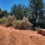
Pioneer Cemetery Trail

Connects: Annie’s Wishing Tree, Linwood Cemetery, Doc Holliday’s Grave, Kid Curry’s Grave View Larger Map

Posted in 1-3 Miles, Dirt, Dog Friendly, Fat Biking, Glenwood Springs, Hiking, Historic, Less Than A Mile, Medium, Moderate, Mountain Biking, Running, Snow, Snowshoeing, Trails, Winter Trail Tagged with: , ,

Porcupine Trail

Connects: Prince Creek, BLM Road 8320, Plunge Trail (Downhill Only), English Trim Trail, Trough Trail (Downhill Only), Father of Ginormous Trail (Downhill Only), Ginormous Trail, Christmas Tree Trail, Innie Trail, Outie Trail Prince Creek Printable Trail Map The Crown Printable

Posted in 1-3 Miles, 3 Miles, Basalt, Carbondale, Dirt, Dog Friendly, Easy, Fat Biking, Hiking, Medium, Moderate, Mountain Biking, Prince Creek Trail System, Running, Snow, Snowshoeing, The Crown, Trails, Winter Trail Tagged with:

Prince Creek

Prince Creek

Connects: The Crown, BLM Road 8320, BLM Road 8324, BLM Road 8325, Christmas Tree Trail, Creekside Trail, English Trim Trail, Father of Ginormous Trail (Downhill Only), Ginormous Trail, Highline Trail, Innie Trail, Monte Carlo Trail, Monte Carlo Bike Ramp, Outie

Posted in 1-3 Miles, 4-7 Miles, 8-10+ Miles, Basalt, Bike Park, Carbondale, Course, Dirt, Dog Friendly, Easy, Fat Biking, Hard, Hiking, Medium, Moderate, Mountain Biking, Prince Creek Trail System, Recreation Area, Running, Sites, Snow, Snowshoeing, The Crown, Trails, Winter Trail Tagged with: , , ,

Prince Creek Climbing Trail

Connects: Prince Creek, Prince Creek Trail, Prince Creek Road (CR 5, 111), Monte Carlo Trail Carbondale, CO – Medium – Hike, Run, Mountain Bike – Dirt The Prince Creek Climbing Trail is an intermediate/moderate trail you can hike, run and

Posted in 1-3 Miles, Carbondale, Dirt, Fat Biking, Hiking, Medium, Moderate, Mountain Biking, Prince Creek Trail System, Running, Trails

Prince Creek Road (CR 5, 111)

Prince Creek Road

Connects: Prince Creek, The Crown, Highway 133 (West Elk Loop Scenic Byway), Nuche Park, Crystal Valley Trail, Bull Pen, Prince Creek Trail, Prince Creek Climbing Trail, Monte Carlo Trail, BLM Road 8320, Skill Saw Trail, Creekside Trail, Skull Bucket Trail,

Posted in 4-7 Miles, 6 Miles, Basalt, Carbondale, Classic XC Skiing, Dirt, Dog Friendly, Fat Biking, Hiking, Horseback Riding, Medium, Moderate, Mountain Biking, Nordic (XC Ski), Paved, Prince Creek Trail System, Road Biking, Running, Snowshoeing, The Crown, Trails, Winter Trail

Red Mountain Road

Red Mountain Road

Connects: Red Mountain Trail (Jeanne Golay Trail), Grandstaff Trail, Olson Trail, Red Mountain Water Treatment Facility, Red Mountain Cross View Larger Map

Posted in 1-3 Miles, 4 Miles, Classic XC Skiing, Difficult, Dirt, Dog Friendly, Fat Biking, Glenwood Springs, Gravel, Hard, Hiking, Mountain Biking, Nordic (XC Ski), Red Mountain Glenwood Springs, Road Biking, Running, Snow, Snowshoeing, Trails, Walking

Red Mountain Trail (Jeanne Golay Trail/Red Mountain Road)
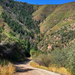
Red Mountain Road

Connects: Cross Trail, Fall Line Trail, Grandstaff Trail, Olson Trail, Red Mountain Cross (7,450 ft) News about the Red Mountain Trail can be found at: Post Independent (November 12, 2017) – Red Mountain trail safety measures taken Red Mountain &

Posted in 1-3 Miles, 3 Miles, Difficult, Dirt, Dog Friendly, Fat Biking, Glenwood Springs, Hard, Hiking, Medium, Moderate, Mountain Biking, Red Mountain Glenwood Springs, Running, Snow, Snowshoeing, Trails, Winter Trail Tagged with: , ,

Richmond Hill Road (FSR #123)

Richmond Hill Road

Connects: Aspen Mountain Sundeck, Nature Trail, East Rim Trail, Midnight Mine Road (FSR #118), Richmond Ridge, Grant’s Cabin, Little Annie Road (CR 15G), Hurricane Point (11,535 ft), Taylor Pass (11,930 ft), Express Creek Road (FSR #122), Barnard Hut View Larger

Posted in 8-10+ Miles, Ashcroft, Aspen, Aspen Mountain (AJAX), Classic XC Skiing, Dirt, Dog Friendly, Fat Biking, Hard, Hiking, More Than 10 Miles, Mountain Biking, Nordic (XC Ski), Running, Snow, Snowshoeing, Trails, Winter Trail Tagged with: , ,

Rio Grande Trail

Rio Grande Trail

Connects: No Problem Joe Trail, Herron Park, Newbury Park, Oklahoma Flats Trail, Rio Grande Park, John Denver Sanctuary, Sheely Bridge (Ron Krajian Bridge), Red Mountain Road (CR 20), Hunter Creek Trail, Grindlay Bridge, Music Tent Trail, Meadows Trail, Meadows Bridge,

Posted in 8-10+ Miles, Aspen, Aspen/Snowmass Nordic Trail System, Basalt, Carbondale, Classic XC Skiing, Dog Friendly, Easy, Fat Biking, Glenwood Springs, Gravel, Hiking, Horseback Riding, More Than 10 Miles, Mountain Biking, Nordic (XC Ski), Paved, Road Biking, Running, Skate Skiing, Snow, Snowshoeing, Trails, Walking, Winter Site, Winter Trail, Woody Creek Tagged with: , , , ,

Smuggler Mountain Road (FSR #131)

Smuggler Mountain Road

Connects: Arbaney Traverse, Mollie Gibson Park (Smuggler Park), Smuggler Mountain, Smuggler Mine, Mascotte 99 Trail, Smuggler Mountain Overlook, Hunter Creek Cutoff Trail, Behind The Sign (BTS) Trail, 10th Mountain Trail, Lollipop Trail, Robbie Wade Picnic Area, Tootsie Roll Trail, Benedict

Posted in 1 Mile, 1-3 Miles, 4-7 Miles, 6 Miles, Aspen, Classic XC Skiing, Dog Friendly, Fat Biking, Hiking, Historic, Medium, Moderate, Mountain Biking, Nordic (XC Ski), Running, Sledding Hill, Smuggler Mountain, Snow, Snowshoeing, Trails, Winter Trail Tagged with: , , , , , , ,

Sunlight Mountain

Sunlight Mountain

Connects: Babbish Trail, Babbish Express Trail, Compass Peak (9,895 ft), Compass Trail, Dippsy Doodle Trail, Garl’s Landing, Glades Trail, Grizzly Summer Road, High Places Chapel, Holiday Hill Trail, Leonard’s Lookout, Little Beaver Trail, Old Four Mile Road, Sun King Uphill

Posted in 1-3 Miles, 4-7 Miles, 8-10+ Miles, Classic XC Skiing, Difficult, Dirt, Dog Friendly, Fat Biking, Glenwood Springs, Hard, Hiking, Medium, Moderate, Mountain Biking, Mountain Peak, Nordic (XC Ski), Nordic Centers and Systems, Nordic Trail, Recreation Area, Rocky, Running, Sites, Skinning, Snow, Snowshoeing, Sunlight Mountain Resort, Trails, Uphilling (SkiMo), Winter Trail

West Elk Trail

Connects: Buford-New Castle Road (FSR #245), Gravel Pit, Forest Service Road #819 New Castle, CO – Medium – Hike, Run, Mountain Bike, Horseback Ride, Dog Friendly – Dirt West Elk Trail #2290 is an intermediate/moderate trail you can hike, run,

Posted in 8-10+ Miles, Classic XC Skiing, Dirt, Dog Friendly, Fat Biking, Hiking, Horseback Riding, Medium, Moderate, More Than 10 Miles, Mountain Biking, New Castle, Nordic (XC Ski), Rifle, Running, Snowshoeing, Trails, Winter Trail

Wulfsohn Mountain Park

Wulfsohn Mountain Park

Connects: Glenwood Springs Whitewater Park, Midland Avenue Trail, Defiance Trail, Olson Trail, Stevie Bob Trail, Vanderhoofin’ It Trail, Wulfsohn Road, Wulfsohn Trail Glenwood Springs, CO – Recreation Area Wulfsohn Mountain Park is a 215 acre open space above the Glenwood

Posted in 1-3 Miles, 4-7 Miles, 8-10+ Miles, Dog Friendly, Easy, Fat Biking, Glenwood Springs, Hard, Hiking, Medium, Moderate, Recreation Area, Running, Sites, Wulfsohn Mountain Park

Trail Search

Find a trail. Use 1 or all 4 drop downs to customize your search for the right trail.

Dog Friendly:

  or  

Park Search

Find a park. Use the drop downs to find the perfect park.

Dog Friendly:

  or  

Featured and Mentioned On

Questions? Email us at info@aspentrailfinder.com
By using this site you agree to the terms of our User Agreement. Read our Disclaimer.