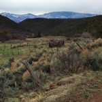
Connects: Cattle Creek Road (CR 113), Red Canyon Road (CR 115), Fisher Cemetery Road (CR 62), Fisher Cemetery The Fisher Creek area, or Haff Pasture, is a Special Management Area with numerous routes and trails near Carbondale and Glenwood Springs,…

Connects: Cattle Creek Road (CR 113), Red Canyon Road (CR 115), Fisher Cemetery Road (CR 62), Fisher Cemetery The Fisher Creek area, or Haff Pasture, is a Special Management Area with numerous routes and trails near Carbondale and Glenwood Springs,…
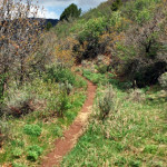
Connects: Boy Scout Loop, Scout Trail, Bear Creek, Hubbard Cave Road (FSR #408) Glenwood Springs, CO – Hard – 5 Miles – Hike, Run, Mountain Bike, Dog Friendly – Dirt Forest Hollow Trail is a difficult trail you can hike,…
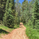
Connects: Arbaney Traverse, Four Corners (9,785 ft), Lenado Trail (Tincup/Tinpot Trail), Hobbit Trail, Secret Trail (Sunnyside Trail), Red Mountain Road (FSR #130.3), Van Horn Lookout Trail, Van Horn Park (9,900 ft) Aspen, CO – Medium – 1 Mile – Hike,…
Connects: Four Mile Road (CR 117), Sunlight Mountain, Sunlight Peak Road (FSR #318), Sunlight to Powderhorn Trail (Winter), Four Mile Park, Beaver Creek Trail Distances: Four Mile Road (CR 117) to Four Mile Road (FSR #300) – 9.5 Miles Start…
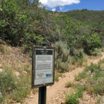
Connects: Prince Creek, Father of Ginormous Trail (Downhill Only), Porcupine Trail, Monte Carlo Trail Carbondale, CO – Medium – 0.30 Miles – Hike, Run, Mountain Bike, Dog Friendly – Dirt Ginormous Trail is an intermediate/moderate downhill only trail you can…
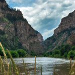
Connects: Glenwood Springs (5,760 ft), Colorado River, Glenwood Canyon Trail, Horseshoe Bend Park, Artist Point (6,540 ft), No Name Rest Area, No Name Trail (Jess Weaver Trail), No Name Canyon, Grizzly Creek Rest Area, Grizzly Creek Trail, Grizzly Creek Canyon,…
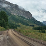
Connects: Mt. Crested Butte, Snodgrass Trail, Gothic, Gothic Bypass Road (FSR #317.3A), Trailriders Trail, Judd Falls Trail, Gothic Campground, Emerald Lake (10,450 ft), Schofield Pass (10,700 ft), Schofield Pass Road (FSR #317) Gothic, CO – Medium – Hike, Run, Horseback…
Connects: Highlands Trail, Moore Trail, Terral Wade Bridge (Tiehack Nordic Bridge), Maroon Creek Trail, Tiehack Trail, Tiehack Summer Road, Oregon Trail, Buttermilk Summer Road, Buttermilk Trail, West Buttermilk Trail, Sugar Bowls Trail, Anaerobic Nightmare Trail, Sequel Trail, Snowmass Bike Park,…
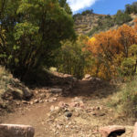
Connects: Red Mountain Trail (Jeanne Golay Trail/Red Mountain Road), Fall Line Trail, Cross Trail, Red Mountain Cross (7,450 ft) Glenwood Springs, CO – Medium – 3.5 Miles – Hike, Run, Mountain Bike, Dog Friendly – Dirt The Grandstaff Trail is…
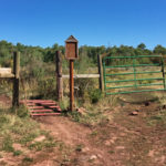
Connects: Red Table Road (FSR #514) Basalt, Carbondale, CO – Medium – Hike, Run, Mountain Bike, Horseback Ride, Dog Friendly – Dirt Green Gate Trail #1903 is an intermediate/moderate trail you can hike, run, mountain bike, and horseback ride that…
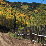
Connects: Ute Summer Road, Leonard’s Lookout, Garl’s Landing, Compass Peak (9,895 ft) Glenwood Springs, CO – Medium – 2.8 Miles – Hike, Run, Mountain Bike, Dog Friendly – Dirt Grizzly Summer Road is an intermediate/moderate road you can hike, run,…
Connects: Highway 133 (West Elk Loop Scenic Byway), Bogan Flats Campground, Marble Cemetery, Marble Airstrip (7,800 ft), Marble (7,990 ft), Marble Quarry Road (CR 3C), Marble Mill Site Park, Marble Disc Golf Course, Beaver Lake State Wildlife Area, Daniels Hill,…