Connects: Rifle Falls State Park, Coyote Trail More information about the Rifle Falls State Park can be found at: Colorado Parks & Wildlife – Rifle Falls Trails Squirrel Trail Map Rifle Falls State Park View Larger Map

Connects: Rifle Falls State Park, Coyote Trail More information about the Rifle Falls State Park can be found at: Colorado Parks & Wildlife – Rifle Falls Trails Squirrel Trail Map Rifle Falls State Park View Larger Map

Connects: Colorow Trail New Castle, CO – Medium – 1 Mile – Hike, Run, Mountain Bike, Dog Friendly – Dirt The Stairway to Heaven Trail is an intermediate/moderate trail you can hike, run and mountain bike that is dog friendly.…
Connects: Owl Creek Trail, Powerline Trail, Tom Blake Trail Snowmass Village, CO – Easy – 1.24 Miles – Walk, Hike, Run, Mountain Bike, Dog Friendly – Paved/Dirt Stark’s Trail is an easy trail you can walk, hike, run, and bike…
Connects: ABC Trail, Stein Bridge, Rio Grande Trail, Stein Falls, Double Bar X Ranch Nature Preserve (Private) Aspen, CO – Easy – 0.6 Miles – Hike, Run, Mountain Bike, Horseback Ride, Dog Friendly – Dirt Stein Trail is an easy…
Connects: Wulfsohn Mountain Park, Wulfsohn Trail, Vanderhoofin’ It Trail, Wulfsohn Road Glenwood Springs, CO – Medium – 1.2 Miles – Hike, Run, Mountain Bike, Dog Friendly – Dirt Stevie Bob Trail is an intermediate/moderate trail you can hike, run, and…
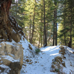
Connects: Little Annie Road (CR 15G), Dick Cabins, Dick Picnic Area, Quien Sabe Mine, Storm King Cabin Aspen, CO – Hard – Hike, Run, Dog Friendly – Dirt Stirling Wilderness Trail, also called Stirling Cooper Trail, is a difficult trail…
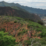
Glenwood Springs, CO – Medium – 2 Miles – Hike – Dirt The Storm King Fourteen Memorial Trail is an intermediate/moderate trail you can hike. The trail is in memory of the 14 firefighters who died there during the South…
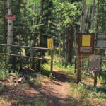
Connects: Buttermilk Summer Road, Buttermilk Trail, West Buttermilk Warming Hut, West Buttermilk Trail, Government Trail Aspen, CO – Hard – 1.7 Miles – Hike, Run, Mountain Bike, Dog Friendly – Dirt The Sugar Bowls Trail is a difficult trail you…
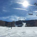
Glenwood Springs, CO – Hard – 1.5 Miles – Uphill, Snowshoe – Snow Sun King Uphill Route is a difficult route you can skin and snowshoe up. This is a 1.5 mile uphill route on Sunlight Mountain in Glenwood Springs,…
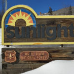
Connects: Babbish Trail, Babbish Express Trail, Compass Peak (9,895 ft), Compass Trail, Dippsy Doodle Trail, Garl’s Landing, Glades Trail, Grizzly Summer Road, High Places Chapel, Holiday Hill Trail, Leonard’s Lookout, Little Beaver Trail, Old Four Mile Road, Sun King Uphill…
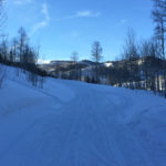
Connects: Marion Cemetery Road (CR 123), Marion Cemetery, Marion Gulch Trail, Sunlight Mountain, Four Mile Road (FSR #300), Powderhorn Mountain Carbondale, Glenwood Springs, Grand Junction, CO – 120 Miles – Difficulty Varies – Snowshoe, Classic XC Ski – Snow The…
Connects: Lower Sunshine Trail, Tenderfoot Trail, Old Four Mile Road, Sunlight Backcountry Cabin, Williams Trail, Babbish Trail Glenwood Springs, CO – Easy – Snowshoe, Classic XC Ski, Dog Friendly – Snow Sunshine Trail is an easy winter trail you can…