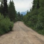
Perham Creek Trail

Perham Creek Trail

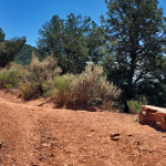
Connects: Highway 133 (West Elk Loop Scenic Byway) Carbondale, CO – Medium – 4.2 Miles – Hike, Run, Horseback Ride, Dog Friendly – Dirt Perham Creek Trail #1949 is an intermediate/moderate trail you can hike, run, and horseback ride that

Posted in 4 Miles, 4-7 Miles, Carbondale, Dirt, Dog Friendly, Hiking, Horseback Riding, Medium, Moderate, Redstone, Running, Trails

Pioneer Cemetery Trail (Doc Holliday Trail)

Pioneer Cemetery Trail

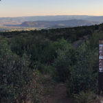
Connects: Annie’s Wishing Tree, Linwood Cemetery, Doc Holliday’s Grave, Kid Curry’s Grave View Larger Map
Posted in 1-3 Miles, Dirt, Dog Friendly, Fat Biking, Glenwood Springs, Hiking, Historic, Less Than A Mile, Medium, Moderate, Mountain Biking, Running, Snow, Snowshoeing, Trails, Winter Trail Tagged with: , ,

Plunge Trail (Downhill Only)

Plunge Trail

Connects: Prince Creek, BLM Road 8320, Porcupine Trail, Highline Trail Carbondale, CO – Medium – Hike, Run, Mountain Bike, Dog Friendly – Dirt Plunge Trail is an intermediate/moderate trail you can hike, run and mountain bike that is dog friendly.

Posted in 1-3 Miles, Basalt, Carbondale, Dirt, Dog Friendly, Hiking, Less Than A Mile, Medium, Moderate, Mountain Biking, Prince Creek Trail System, Running, The Crown, Trails

Plunge Trail (Sunnyside Trail)

Plunge Trail

Connects: Sunnyside Trail, Secret Trail, Hummingbird Trail, Hunter Valley Trail Aspen, CO – Hard – 1.6 Miles – Hike, Run, Mountain Bike, Dog Friendly – Dirt Plunge Trail, a section of the Sunnyside Trail, is a difficult trail you can

Posted in 1-3 Miles, 2 Miles, Aspen, Dirt, Dog Friendly, Hard, Hiking, Mountain Biking, Running, Trails Tagged with:

Ponderosa Trail

Ponderosa Trail

Connects: Ponderosa Park, Emma Bridge (7-Eleven Bridge) Basalt, CO – Easy – Hike, Run, Mountain Bike, Dog Friendly – Dirt Ponderosa Trail is an easy trail you can hike, run, and mountain bike that is dog friendly. This is a

Posted in 1 Mile, 1-3 Miles, Basalt, Dirt, Dog Friendly, Easy, Hiking, Mountain Biking, Running, Trails

Porcupine Trail

Connects: Prince Creek, BLM Road 8320, Plunge Trail (Downhill Only), English Trim Trail, Trough Trail (Downhill Only), Father of Ginormous Trail (Downhill Only), Ginormous Trail, Christmas Tree Trail, Innie Trail, Outie Trail Prince Creek Printable Trail Map The Crown Printable

Posted in 1-3 Miles, 3 Miles, Basalt, Carbondale, Dirt, Dog Friendly, Easy, Fat Biking, Hiking, Medium, Moderate, Mountain Biking, Prince Creek Trail System, Running, Snow, Snowshoeing, The Crown, Trails, Winter Trail Tagged with:

Power of 1 Trail

Power of One Trail

Connects: Aspen Mountain Summer Road (Aspen Mountain Trail), Little Nell Trail, Bill Zaugg’s Cabin, West Side Trail, East Rim Trail Aspen, CO – Hard – 2.25 Miles – Hike, Run, Mountain Bike, Dog Friendly – Dirt The Power of 1

Posted in 1-3 Miles, 2 Miles, Aspen, Aspen Mountain (AJAX), Difficult, Dirt, Dog Friendly, Hard, Hiking, Mountain Biking, Running, Trails Tagged with:

Prendergast Hill Trail

Connects: Jolley Trail New Castle, CO – Medium – 0.7 Miles – Hike, Run, Mountain Bike – Dirt Prendergast Hill Trail, also called Jolleytop Trail, is an intermediate/moderate trail you can hike, run, mountain bike. This is a 0.7 mile

Posted in 1-3 Miles, Dirt, Hiking, Less Than A Mile, Medium, Moderate, Mountain Biking, New Castle, Running, Trails Tagged with: ,

Prince Creek

Prince Creek

Connects: The Crown, BLM Road 8320, BLM Road 8324, BLM Road 8325, Christmas Tree Trail, Creekside Trail, English Trim Trail, Father of Ginormous Trail (Downhill Only), Ginormous Trail, Highline Trail, Innie Trail, Monte Carlo Trail, Monte Carlo Bike Ramp, Outie

Posted in 1-3 Miles, 4-7 Miles, 8-10+ Miles, Basalt, Bike Park, Carbondale, Course, Dirt, Dog Friendly, Easy, Fat Biking, Hard, Hiking, Medium, Moderate, Mountain Biking, Prince Creek Trail System, Recreation Area, Running, Sites, Snow, Snowshoeing, The Crown, Trails, Winter Trail Tagged with: , , ,

Prince Creek Climbing Trail

Connects: Prince Creek, Prince Creek Trail, Prince Creek Road (CR 5, 111), Monte Carlo Trail Carbondale, CO – Medium – Hike, Run, Mountain Bike – Dirt The Prince Creek Climbing Trail is an intermediate/moderate trail you can hike, run and

Posted in 1-3 Miles, Carbondale, Dirt, Fat Biking, Hiking, Medium, Moderate, Mountain Biking, Prince Creek Trail System, Running, Trails

Prince Creek Road (CR 5, 111)

Prince Creek Road

Connects: Prince Creek, The Crown, Highway 133 (West Elk Loop Scenic Byway), Nuche Park, Crystal Valley Trail, Bull Pen, Prince Creek Trail, Prince Creek Climbing Trail, Monte Carlo Trail, BLM Road 8320, Skill Saw Trail, Creekside Trail, Skull Bucket Trail,

Posted in 4-7 Miles, 6 Miles, Basalt, Carbondale, Classic XC Skiing, Dirt, Dog Friendly, Fat Biking, Hiking, Horseback Riding, Medium, Moderate, Mountain Biking, Nordic (XC Ski), Paved, Prince Creek Trail System, Road Biking, Running, Snowshoeing, The Crown, Trails, Winter Trail

Prince Creek Trail

Connects: Prince Creek, Prince Creek Road (CR 5, 111), Bull Pen, Prince Creek Climbing Trail, Monte Carlo Trail Carbondale, CO – Easy – 1.4 Miles – Hike, Run, Mountain Bike, Dog Friendly – Dirt The Prince Creek Trail is an

Posted in 1 Mile, 1-3 Miles, Carbondale, Dirt, Dog Friendly, Easy, Hiking, Mountain Biking, Prince Creek Trail System, Running, The Crown, Trails

Rabbit Run Trail

Connects: Elk Camp, Elk Camp Pond, Sierra Club Trail Snowmass Village, CO – Easy – 0.75 Miles – Hike, Run, Dog Friendly – Dirt Rabbit Run Trail, also called Rabbit Run Interpretive Trail, is an easy trail you can hike

Posted in 1-3 Miles, Dirt, Dog Friendly, Easy, Hiking, Less Than A Mile, Running, Snowmass Ski Area, Snowmass Village, Trails Tagged with: ,

Ragged Mountain Road (FSR #898)

Ragged Mountain Road

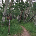
Connects: Highway 133 (West Elk Loop Scenic Byway), McClure Pass (8,755 ft), Raggeds Trail View Larger Map
Posted in 4-7 Miles, 5 Miles, Carbondale, Classic XC Skiing, Dirt, Dog Friendly, Hiking, Horseback Riding, Marble, Medium, Moderate, Mountain Biking, Nordic (XC Ski), Raggeds Wilderness, Running, Snow, Snowshoeing, Trails, Winter Trail Tagged with: ,

Raggeds Trail

Raggeds Trail

Connects: Ragged Mountain Road (FSR #898), Buck Creek, Spring Creek, Munsey Creek Road (FSR #795) Marble, Paonia, CO – Medium – 14 Miles – Hike, Run, Mountain Bike, Horseback Ride, Dog Friendly – Dirt The Raggeds Trail #820 is an

Posted in 8-10+ Miles, Dirt, Dog Friendly, Hiking, Horseback Riding, Marble, Medium, Moderate, More Than 10 Miles, Mountain Biking, Raggeds Wilderness, Running, Trails

Trail Search

Find a trail. Use 1 or all 4 drop downs to customize your search for the right trail.

Dog Friendly:

  or  

Park Search

Find a park. Use the drop downs to find the perfect park.

Dog Friendly:

  or  

Featured and Mentioned On

Questions? Email us at info@aspentrailfinder.com
By using this site you agree to the terms of our User Agreement. Read our Disclaimer.