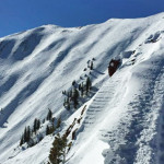
Connects: Loge Peak Lift, Deep Temerity Lift, Aspen Highlands Ski Patrol Station, The Shire Beacon Park, Highland Peak (12,392 ft) Aspen, CO – Hard – 0.75 Miles – Hike, Snowshoe – Snow Highland Bowl Trail is a difficult trail you…

Connects: Loge Peak Lift, Deep Temerity Lift, Aspen Highlands Ski Patrol Station, The Shire Beacon Park, Highland Peak (12,392 ft) Aspen, CO – Hard – 0.75 Miles – Hike, Snowshoe – Snow Highland Bowl Trail is a difficult trail you…
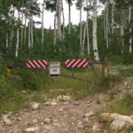
Connects: Highway 133 (West Elk Loop Scenic Byway), McClure Pass (8,755 ft) Marble, CO – Hard – Hike, Run, Mountain Bike, Horseback Ride, Dog Friendly – Rocky/Dirt Huntsman Ridge Road (FSR #517), also called Huntsman Ridge Trail, is a difficult…
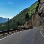
Connects: Anderson Park, Snyder Park Trail, East of Aspen Trail, North Star Nature Preserve, North Star Beach, Difficult Trail, Weller Lake Trail, Weller Campground, Devil’s Punchbowl, Grottos Trail, Lincoln Creek Road (FSR #106), Braille Trail, Discovery Trail, Lost Man Campground,…
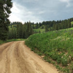
Connects: Arbaney Traverse, Larkspur Mountain Road (FSR #103), Hannon Creek Trail, Kobey Park, Forest Service Road #513, Kobey Trail Woody Creek, CO – Hard – Hike, Run, Mountain Bike, Horseback Ride, Dog Friendly – Dirt Kobey Park Road (FSR #508)…
Connects: Arbaney Traverse, Arbaney Kittle Trail, Red Canyon Trail, Old Colorado Mountain Club Cabin, Forest Service Road #513, Kobey Park Road (FSR #508) Lenado, CO – Hard – 3 Miles – Hike, Run, Mountain Bike, Horseback Ride, Dog Friendly –…
Connects: Gunnison County Road 3, Daniels Hill, Lead King Loop, North Lost Trail, Silver Creek Trail, Schofield Pass Road (FSR #317), Crystal City Road (FSR #314), Avalanche Pass Trail Marble, CO – Hard – Hike, Run, Mountain Bike, Horseback Ride,…
Connects: Aspen to Marble, Marble to Crested Butte, Daniels Hill, Lead King Basin Road (FSR #315), North Lost Trail, Avalanche Pass Trail, Arkansas Mountain Trail, Silver Creek Trail, Schofield Pass Road (FSR #317), Crystal City Road (FSR #314), Crystal City…
Connects: East Creek Trail, Placita Trail Redstone, CO – Hard – 10 Miles – Hike, Run, Horseback Ride, Dog Friendly – Dirt Lily Lake Trail #1964, also called Kline Creek Trail, is a difficult trail you can hike, run, and…
Connects: Independence Pass Road (HWY 82), Lost Man Trail, Linkins Lake (12,008 ft) Aspen, CO – Hard – 0.6 Miles – Hike, Run, Horseback Ride, Dog Friendly – Dirt Linkins Lake Trail #1979 is a difficult trail you can hike,…
Connects: Castle Creek Road (CR 15), Midnight Mine Road (FSR #118), Aspen Mountain Sundeck, Richmond Hill Road (FSR #123)
Connects: Sunlight Mountain, Old Four Mile Road, Tenderfoot Trail, Glades Trail, Dippsy Doodle Trail Glenwood Springs, CO – Hard – Snowshoe, Classic XC Ski, Dog Friendly – Snow Little Beaver Trail is a difficult winter trail you can snowshoe and…
Connects: Spring Gulch, Rafter T Trail (XC Only), Holdens Trail (XC Only) Carbondale, CO – Hard – Classic XC Ski, Skate Ski – Snow Little Dipper Trail is a difficult winter trail for cross-country skiing only. This is a groomed…
Connects: Aspen Mountain Summer Road (Aspen Mountain Trail), AJAX Trail, West Side Trail, Power of 1 Trail Aspen, CO – Hard – 1.5 Miles – Hike, Run, Mountain Bike, Dog Friendly – Dirt The Little Nell Trail is a difficult…