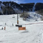
Connects: Exhibition Lift Aspen, CO – Hard – Uphill, Snowshoe – Snow Aspen Highlands Uphill Route is a difficult route you can skin and snowshoe up. This is an uphill trail on Aspen Highlands Mountain in Aspen, CO. This route…

Connects: Exhibition Lift Aspen, CO – Hard – Uphill, Snowshoe – Snow Aspen Highlands Uphill Route is a difficult route you can skin and snowshoe up. This is an uphill trail on Aspen Highlands Mountain in Aspen, CO. This route…
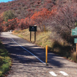
Connects: Brush Creek Trail, Roaring Fork River, Jaffee Park, Rio Grande Trail Aspen, CO – Easy – 0.7 Miles – Walk, Run, Road Bike, Dog Friendly – Paved The Aspen Mass Trail is an easy trail you can walk, run,…
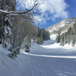
Connects: Silver Queen Gondola Aspen, CO – Hard – Uphill, Snowshoe – Snow Aspen Mountain Uphill Route is a difficult route you can skin and snowshoe up. Uphillers must turn around at 9 a.m., if they are not at the…
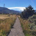
Connects: Upper River Road (CR 17), Red Canyon Trail Aspen, CO – Medium – 1.75 Miles – Hike, Run, Mountain Bike, Horseback Ride, Dog Friendly – Dirt Aspen Valley Ranch Trail is an intermediate/moderate trail you can hike, run, mountain…
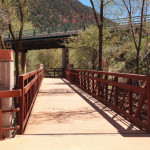
Connects: Three Mile Park Glenwood Springs, CO – Easy – 1.4 Miles – Walk, Run, Road Bike, Dog Friendly – Paved Atkinson Canal Trail is an easy trail you can walk, run, and bike that is dog friendly. This is…
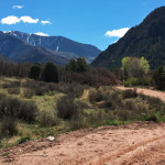
Connects: Highway 133 (West Elk Loop Scenic Byway), Janeway Trail, Janeway Campground, Bulldog Creek Trail, Avalanche Campground, Avalanche Creek Trail View Larger Map
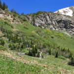
Connects: Lead King Loop, Lead King Basin Road (FSR #315), North Lost Trail, Carbonate Creek Trail, Buckskin Basin, Avalanche Pass (12,100 ft) Marble, CO – Hard – 3.7 Miles – Hike, Run, Horseback Ride, Dog Friendly – Dirt Avalanche Pass…
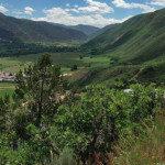
Connects: Southside Trail, Rio Grande Trail, Grace Shehi Community Garden, Grace Shehi Bike Park, BLM Road 8334, BLM Road 8335, Light Hill Basalt, CO – Medium – Hike, Run, Mountain Bike, Dog Friendly – Dirt The Basalt High School Trail…
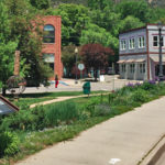
Connects: Basalt Chamber of Commerce Caboose, Codgers Corner, Alpine Bank / Basalt Building, Centennial Sculpture, Frying Pan Inn/Colorado Midland Hotel, Swinging Bridge, Arbaney Barn, Arbaney Residence, Frying Pan Coke Ovens, Arbaney Park, Berm Trail, Luchsinger Halfway House, Pueblo Bridge, Basalt…
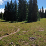
Connects: Basalt Mountain Road (FSR #524), Cattle Creek Trail, Red Table Trail Basalt, CO – Medium – 3.5 Miles – Hike, Run, Mountain Bike, Horseback Ride, Dog Friendly – Dirt Basalt Mountain Trail #1911 is an intermediate/moderate trail you can…
Connects: Beaver Creek Trail (Rifle) View Larger Map
Connects: Four Mile Road (FSR #300), Four Mile Park, Yank Creek Glenwood Springs, CO – Easy – 3.5 Miles – Hike, Run, Mountain Bike, Horseback Ride, Dog Friendly – Dirt Beaver Creek Trail #2092 is an easy trail you can…
Connects: CR 317, Beaver Creek Road (FSR #824) Rifle, CO – Medium – 3.5 Miles – Hike, Run, Mountain Bike, Horseback Ride, Dog Friendly – Dirt Beaver Creek Trail is an intermediate/moderate trail you can hike, run, mountain bike, and…
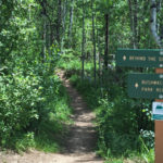
Connects: Smuggler Mountain, Smuggler Mountain Road (FSR #131), Smuggler Mountain Overlook, Hunter Creek Cutoff Trail, Bushwacker Mine, Park Regent Mine, 10th Mountain Trail, Lollipop Trail Aspen, CO – Medium – 0.65 Miles – Hike, Run, Mountain Bike, Dog Friendly –…
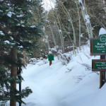
Connects: Ute Trail, North Star Loop (Winter) Aspen, CO – Medium – 1.77 KM (1.1 Miles) – Classic XC Ski – Snow Benedict Trail is an intermediate/moderate winter use trail for cross-country skiing only. This is a nordic trail that…