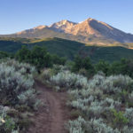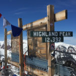
Highland Peak (12,392 ft)

highland peak

Connects: Aspen Highlands, Highland Bowl Trail Aspen, CO – Mountain Peak Highland Peak (12,392 ft) is the peak of Aspen Highlands Mountain primarily accessed by the Highland Bowl Trail. This is a mountain peak in Aspen, CO. View Larger Map
Posted in Aspen Highlands Mountain, Mountain Peak, Sites, Winter Site Tagged with:

Highline Trail

Highline Trail

Connects: Sky Mountain Park, Snowmass Loop, Viewline Trail, Hidden Valley Cemetery, Lowline Trail, Owl Creek Trail, Tom Blake Trail, Tom Blake Equestrian Trail Snowmass Village, CO – Easy – 1.5 Miles – Hike, Run, Mountain Bike, Dog Friendly – Dirt

Posted in 1 Mile, 1-3 Miles, Dirt, Dog Friendly, Easy, Hiking, Mountain Biking, Running, Sky Mountain Park, Snowmass Village, Trails

Highline Trail

Highline Trail

Connects: Prince Creek, BLM Road 8320, Plunge Trail Carbondale, CO – Medium – 0.8 Miles – Hike, Run, Mountain Bike, Dog Friendly – Dirt Highline Trail is an intermediate/moderate trail you can hike, run and mountain bike that is dog

Posted in 1-3 Miles, Basalt, Carbondale, Dog Friendly, Hiking, Less Than A Mile, Medium, Moderate, Mountain Biking, Prince Creek Trail System, Running, The Crown, Trails

Hillside Trail

Hillside Trail

Connects: Basalt State Wildlife Area Basalt, CO – Medium – Hike, Run – Dirt Hillside Trail is an intermediate/moderate trail you can hike and run. Winter closure Dec. 1 to April 15. Hunting takes place in October & November in

Posted in Basalt, Basalt State Wildlife Area, Dirt, Hiking, Medium, Moderate, Running, Trails

Hubbard Cave Road (FSR #408)

Hubbard Cave Road

Connects: Boy Scout Loop, Lookout Mountain Road (CR 120), Forest Hollow Trail, Hubbard Cave Trail, Little Grand Mesa Road (FSR #535) Glenwood Springs, CO – Hard – 9 Miles – Hike, Run, Mountain Bike, Dog Friendly – Dirt Hubbard Cave

Posted in 8-10+ Miles, 9 Miles, Difficult, Dirt, Dog Friendly, Glenwood Springs, Hard, Hiking, Lookout Moutain, Mountain Biking, Running, Trails Tagged with: , ,

Hunter Creek Cutoff Trail

Hunter Creek Cutoff

Connects: Smuggler Mountain, Arbaney Traverse, Smuggler Mountain Road (FSR #131), Smuggler Mountain Overlook, Behind The Sign (BTS) Trail, 10th Mountain Trail, Iowa Shaft Mine, Iowa Shaft Trail, Hunter Creek Trail Aspen, CO – Medium – 1.1 Miles – Hike, Run,

Posted in 1 Mile, 1-3 Miles, Aspen, Dirt, Dog Friendly, Hiking, Medium, Moderate, Mountain Biking, Running, Smuggler Mountain, Trails Tagged with:

Hunter Valley Trail

Hunter Valley Trail

Connects: Smuggler Mountain, Hunter Creek Trail, Hunter Creek Cutoff, Iowa Shaft Trail, 10th Mountain Bridge, Sunnyside Trail, Plunge Trail (Sunnyside Trail), Hummingbird Trail View Larger Map

Posted in 4-7 Miles, 7 Miles, Aspen, Classic XC Skiing, Dirt, Dog Friendly, Fat Biking, Hiking, Horseback Riding, Hunter-Fryingpan Wilderness, Medium, Moderate, Mountain Biking, Nordic (XC Ski), Running, Snow, Snowshoeing, Trails, Winter Trail Tagged with: , ,

Hurricane Point (11,535 ft)

Connects: Richmond Hill Road (FSR #123), Upper Hurricane Road Aspen, CO – Viewing Area Hurricane Point (11,535 ft) is the top of Richmond Ridge accessed by Richmond Hill Road (FSR #123) on the backside of Aspen Mountain in Aspen, CO.

Posted in Aspen, Aspen Mountain (AJAX), Mountain Peak, Sites, Viewing Area Tagged with:

Ice Caves (Grottos)

grottos ice caves

Connects: Grottos Trail, Cascades View Larger Map

Posted in Aspen, Cave, Ice, Ice Cave, Independence Pass, Sites, Snow, Winter Site Tagged with:

Independence Ghost Town

Independence Ghost Town

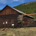
Connects: Independence Pass Road (HWY 82), Green Mountain Trail Aspen, CO – Ghost Town The Independence Ghost Town is a historic gold and silver mining town. At its’ peak in 1882 the Town of Independence had over 40 businesses, 3

Posted in Aspen, Ghost Town, Historic, Independence Pass, Sites Tagged with: , ,

Independence Lake (12,497 ft)

Independence Lake

Connects: Lost Man Trail, Lost Man Pass (12,805 ft) Aspen, CO – Lake Independence Lake (12,497 ft) is an alpine lake accessed by the Lost Man Trail in the Hunter-Fryingpan Wilderness near Aspen, CO. More information about Independence Lake can

Posted in Aspen, Hunter-Fryingpan Wilderness, Independence Pass, Lake, Sites, Water Tagged with:

Independence Pass (12,095 ft)

Independence Pass

Connects: Independence Pass Road (HWY 82), Independence Pass Scenic Trail, Continental Divide Trail (Independence Pass) Aspen, CO – Mountain Pass Independence Pass (12,095 ft), originally called Hunter Pass, is a mountain pass along the Continental Divide accessed by Highway 82

Posted in Aspen, Independence Pass, Mountain Pass, Sites Tagged with: ,

Independence Pass Road (HWY 82)

Independence Pass Road

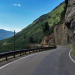
Connects: Anderson Park, Snyder Park Trail, East of Aspen Trail, North Star Nature Preserve, North Star Beach, Difficult Trail, Weller Lake Trail, Weller Campground, Devil’s Punchbowl, Grottos Trail, Lincoln Creek Road (FSR #106), Braille Trail, Discovery Trail, Lost Man Campground,

Posted in 8-10+ Miles, Aspen, Classic XC Skiing, Fat Biking, Hard, Independence Pass, More Than 10 Miles, Nordic (XC Ski), Paved, Road Biking, Skate Skiing, Snow, Trails, Winter Trail Tagged with: , , , , , ,

Independence Pass Scenic Trail

Independence Pass Scenic Trail

Connects: Independence Pass (12,095 ft), Independence Pass Road (HWY 82), Continental Divide Trail Aspen, CO – Easy – 0.5 Mile Loop – Walk, Dog Friendly – Paved The Independence Pass Scenic Trail is an easy trail you can walk that

Posted in 1-3 Miles, Aspen, Dog Friendly, Easy, Independence Pass, Less Than A Mile, Paved, Trails, Walking Tagged with: ,

Innie Trail

Innie Trail

Connects: The Crown, Prince Creek, Porcupine Trail, Outie Trail Carbondale, CO – Medium – 3.4 Miles – Hike, Run, Mountain Bike, Dog Friendly – Dirt Innie Trail is an intermediate/moderate trail you can hike, run and mountain bike that is

Posted in 1-3 Miles, 3 Miles, Basalt, Carbondale, Dirt, Dog Friendly, Hiking, Medium, Moderate, Mountain Biking, Prince Creek Trail System, Running, The Crown, Trails

Trail Search

Find a trail. Use 1 or all 4 drop downs to customize your search for the right trail.

Dog Friendly:

  or  

Park Search

Find a park. Use the drop downs to find the perfect park.

Dog Friendly:

  or  

Featured and Mentioned On

Questions? Email us at info@aspentrailfinder.com
By using this site you agree to the terms of our User Agreement. Read our Disclaimer.