Grizzly Summer Road

Grizzly Summer Road

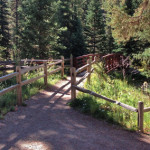
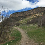
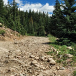
Connects: Ute Summer Road, Leonard’s Lookout, Garl’s Landing, Compass Peak (9,895 ft) Glenwood Springs, CO – Medium – 2.8 Miles – Hike, Run, Mountain Bike, Dog Friendly – Dirt Grizzly Summer Road is an intermediate/moderate road you can hike, run,

Posted in 1-3 Miles, 3 Miles, Dirt, Dog Friendly, Glenwood Springs, Hiking, Medium, Moderate, Mountain Biking, Running, Sunlight Mountain Resort, Trails Tagged with:

Grottos Trail

Grottos Trail

Connects: Independence Pass Road (HWY 82), Cascades, Ice Caves, Lincoln Gulch Campground View Larger Map
Posted in 1-3 Miles, Aspen, Dog Friendly, Easy, Hiking, Independence Pass, Less Than A Mile, Medium, Moderate, Rocky, Snow, Snowshoeing, Trails, Winter Trail Tagged with: , , ,

Gunnison County Road 3

Gunnison County Road 3

Connects: Highway 133 (West Elk Loop Scenic Byway), Bogan Flats Campground, Marble Cemetery, Marble Airstrip (7,800 ft), Marble (7,990 ft), Marble Quarry Road (CR 3C), Marble Mill Site Park, Marble Disc Golf Course, Beaver Lake State Wildlife Area, Daniels Hill,

Posted in 8 Miles, 8-10+ Miles, Dirt, Marble, Medium, Moderate, Mountain Biking, Paved, Road Biking, Trails

Hadley Gulch Trail

Hadley Gulch Trail

Connects: Main Elk Road (CR 243), Clinetop Road (FSR #603), Forest Service Road #653 New Castle, CO – Medium – 7 Miles – Hike, Run, Horseback Ride, Dog Friendly – Dirt Hadley Gulch Trail #1840 is an intermediate/moderate trail you

Posted in 4-7 Miles, 7 Miles, Dirt, Dog Friendly, Glenwood Springs, Hiking, Horseback Riding, Medium, Moderate, New Castle, Running, Trails

Hagerman Pass (11,925 ft)

Hagerman Pass

Connects: Hagerman Pass Road (FSR #105) Leadville, CO – Mountain Pass Hagerman Pass (11,925 ft) is a mountain pass along the continental divide accessed by Hagerman Pass Road (FSR #105) that connects Basalt to Leadville. Hagerman Pass Road is closed

Posted in Basalt, Continental Divide, Dirt, Leadville, Meredith, Mountain Pass, Nast, Norrie, Sites

Hagerman Pass Road (FSR #105)

Hagerman Pass Road

Connects: Frying Pan Road (CR 104), Sellar Meadow (9,630 ft), Sellar Coke Ovens, Forest Service Road #502, Hell Gate, Ivanhoe Lake Road (FSR #527), Lyle/Mormon Lake Trail, Ivanhoe Lake Road (FSR #527), Busk-Ivanhoe Tunnel, Lyle/Mormon Lakes Trail, Hagerman Pass (11,925

Posted in 8-10+ Miles, Basalt, Classic XC Skiing, Dirt, Dog Friendly, Hard, Hiking, Horseback Riding, Leadville, Meredith, More Than 10 Miles, Mountain Biking, Nordic (XC Ski), Norrie, Rocky, Running, Snow, Snowshoeing, Trails

Haleakala Crater

Haleakala Crater

Connects: High School Trail, Aspen High School Trails (Winter) Aspen, CO – Crater Haleakala Crater is a cratered area, created by a berm between the Meadowood neighborhood and the high school, with trails near the Aspen High School in Aspen,

Posted in Aspen, Open Space, Recreation Area, Sites, Winter Site

Hanging Lake (7,175 ft)

Bridal Veil Falls

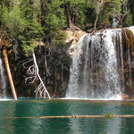
Connects: Hanging Lake Trail, Spouting Rock (7,323 ft) Glenwood Springs, CO – Lake NOTE: A permit is now required to visit Hanging Lake. Visit www.visitglenwood.com/hanginglake, or call Hanging Lake visitor information: (970) 384-6309. Questions? Frequently Asked Questions. Hanging Lake (7,175 ft) is a 1.5 acre lake

Posted in Glenwood Canyon, Glenwood Springs, Lake, Sites, Water, Waterfall, Winter Site

Hanging Lake Trail

Hanging Lake Trail

Connects: Glenwood Canyon, Hanging Lake Rest Area, Glenwood Canyon Trail, Dead Horse Creek, Dead Horse Trail, Hanging Lake (7,175 ft), Spouting Rock (7,323 ft) View Larger Map

Posted in 1 Mile, 1-3 Miles, Difficult, Dirt, Glenwood Springs, Hard, Hiking, Rocky, Snow, Snowshoeing, Trails, Winter Trail Tagged with: , , ,

Hannon Creek Trail

Connects: Woody Creek Road (CR 18), Kobey Park Road (FSR #508) Woody Creek, CO – Hard – 5.3 Miles – Hike, Run, Mountain Bike, Horseback Ride, Dog Friendly – Dirt Hannon Creek Trail is a difficult trail you can hike,

Posted in 4-7 Miles, 5 Miles, Aspen, Difficult, Dirt, Dog Friendly, Hard, Hiking, Horseback Riding, Mountain Biking, Running, Trails, Woody Creek

Hardscrabble Lake (10,140 ft)

Hardscrabble Lake

Connects: Hell Roaring Trail Old Snowmass, CO – Lake Hardscrabble Lake (10,140 ft) is a lake in the Maroon Bells-Snowmass Wilderness accessed by the Hell Roaring Trail near Old Snowmass, CO. Distances: Hell Roaring Trail (Old Snowmass Trailhead) to Hardscrabble

Posted in Lake, Maroon Bells-Snowmass Wilderness, Old Snowmass, Sites Tagged with:

Hardwick Bridge

Hardwick Bridge

Connects: Roaring Fork River, Hardwick Bridge Road (CR 108), Westbank Trail, Sam Caudill State Wildlife Area Glenwood Springs, CO – Bridge Hardwick Bridge, also called Westbank Bridge, is an old bridge over the Roaring Fork River off Hardwick Bridge Road

Posted in Bridge, Carbondale, Glenwood Springs, Historic, Sites

Hardwick Bridge Road (CR 109)

Connects: Thompson Creek Road (CR 108), Westbank Trail, Hardwick Bridge, Old State Highway 82 (CR 154) Carbondale, Glenwood Springs, CO – Medium – 6.5 Miles – Road Bike – Paved Hardwick Bridge Road (CR 109), also known as Garfield County

Posted in 4-7 Miles, 7 Miles, Carbondale, Glenwood Springs, Medium, Moderate, Paved, Road Biking, Trails

Harry Gates Hut

Connects: Burnt Mountain Road (FSR #506), Montgomery Flats Trail Thomasville, CO – Hut The Harry Gates Hut is a hut that is part of the 10th Mountain Division Hut System available for reservations through the 10th Mountain Division Hut Association.

Posted in Hut, Meredith, Nast, Norrie, Sites, Thomasville Tagged with:

Hasley Basin Trail

Hasley Basin Trail

Connects: Four Pass Loop, West Maroon Trail, Hasley Pass (12,144 ft), Fravert Basin Trail Aspen, CO – Hard – 4.2 Miles – Hike, Run, Horseback Ride, Dog Friendly – Rocky/Dirt Hasley Basin Trail is a difficult trail you can hike,

Posted in 4 Miles, 4-7 Miles, Aspen, Crested Butte, Difficult, Dirt, Dog Friendly, Hard, Hiking, Horseback Riding, Marble, Maroon Bells-Snowmass Wilderness, Rocky, Running, Trails

Trail Search

Find a trail. Use 1 or all 4 drop downs to customize your search for the right trail.

Dog Friendly:

  or  

Park Search

Find a park. Use the drop downs to find the perfect park.

Dog Friendly:

  or  

Featured and Mentioned On

Questions? Email us at info@aspentrailfinder.com
By using this site you agree to the terms of our User Agreement. Read our Disclaimer.