Savage Lakes Trail

Savage Lakes Trail

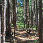
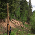
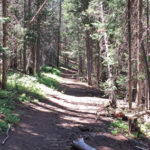
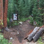
Connects: North Fork Road (FSR #501), Savage Lakes (11,050 ft), Henderson Park Trail Thomasville, CO – Medium – 2 Miles – Hike, Run, Horseback Ride, Dog Friendly – Dirt Savage Lakes Trail #1918 is an intermediate/moderate trail you can hike,

Posted in 1-3 Miles, 2 Miles, Basalt, Dirt, Dog Friendly, Hiking, Holy Cross Wilderness, Horseback Riding, Medium, Meredith, Moderate, Nast, Norrie, Running, Thomasville, Trails Tagged with:

Sawyer Lake (11,025 ft)

Connects: Sawyer Lake Trail Nast, CO – Lake Sawyer Lake (11,025 ft) is a lake near Nast accessed by Sawyer Lake Trail in the Hunter-Fryingpan Wilderness. View Larger Map

Posted in Hunter-Fryingpan Wilderness, Lake, Nast, Sites

Sawyer Lake Trail

Sawyer Lake Trail

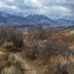
Connects: Twin Meadows (9,465 ft), Sawyer Lake (11,025 ft) Norrie, CO – Medium – 4.7 Mile – Hike, Run, Horseback Ride, Dog Friendly – Dirt Sawyer Lake Trail #1926 is an intermediate/moderate trail you can hike, run, and horseback ride

Posted in 4-7 Miles, 5 Miles, Basalt, Dirt, Dog Friendly, Hiking, Horseback Riding, Hunter-Fryingpan Wilderness, Medium, Meredith, Moderate, Nast, Norrie, Running, Trails

Schofield Pass (10,700 ft)

Aspen Trail Finder App

Connects: Marble to Crested Butte, Schofield Pass Road (FSR #317), Gothic Road (FSR #317), Trailriders Trail Gothic, CO – Mountain Pass Schofield Pass (10,700 ft) is a mountain pass in the Sawatch Range that connects Marble to Crested Butte in

Posted in Crested Butte, Gothic, Marble, Mountain Pass, Sites

Schofield Pass Road (FSR #317)

Connects: Lead King Loop, Lead King Basin Road (FSR #315), Crystal City Road (FSR #314), Crystal Bridge No. 4, Devil’s Punchbowl (Schofield Pass), Schofield Park, West Maroon Trail, Schofield Pass (10,700 ft) Marble, CO – Hard – 8 Miles –

Posted in 8 Miles, 8-10+ Miles, Crested Butte, Difficult, Dog Friendly, Expert, Hard, Hiking, Marble, Mountain Biking, Rocky, Running, Trails Tagged with: , , ,

Scout Trail

Scout Trail

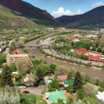
Connects: Boy Scout Loop, Artist Point (6,540 ft), Forest Hollow Trail, Lookout Mountain Park, Lookout Mountain Road (CR 120) Glenwood Springs, CO – Hard – Hike, Run, Mountain Bike, Dog Friendly – Dirt The Scout Trail, also referred to as

Posted in 1-3 Miles, 4-7 Miles, 8-10+ Miles, Difficult, Dirt, Dog Friendly, Glenwood Springs, Hard, Hiking, More Than 10 Miles, Mountain Biking, Running, Trails Tagged with: ,

Secret Trail (Sunnyside Trail)

Secret Trail

Connects: Sunnyside Trail, Plunge Trail (Sunnyside Trail), Four Corners (9,785 ft), Four Corners Road (20B.1), Van Horn Trail, Lenado Trail (Tincup/Tinpot Trail), Red Mountain Road (FSR 130.3) Aspen, CO – Medium – 1.5 Miles – Hike, Run, Mountain Bike, Horseback

Posted in 1-3 Miles, Aspen, Dirt, Dog Friendly, Hiking, Horseback Riding, Less Than A Mile, Medium, Moderate, Mountain Biking, Running, Trails Tagged with:

Sellar Coke Ovens

Sellar Coke Ovens

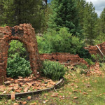
Connects: Hagerman Pass Road (FSR #105), Sellar Meadow (9,630 ft) Nast, CO – Coke Ovens The Sellar Coke Ovens are ruins of charcoal kilns that were built for refining charcoal. This is a site in Sellar Meadow, part of the

Posted in Basalt, Coke Ovens, Meredith, Nast, Norrie, Sites Tagged with: , ,

Sellar Meadow (9,630 ft)

Sellar Meadow

Connects: Hagerman Pass Road (FSR #105), Sellar Coke Ovens Nast, CO – Meadow Sellar Meadow (9,630 ft), also called Sellar Park, is a meadow that is part of the Coke Oven State Wildlife Area along Hagerman Pass Road (FSR #105)

Posted in Basalt, Meredith, Nast, Norrie, Sites, Viewing Area

Sequel Trail

Connects: Tom Blake Trail, Government Trail, Snowmass Bike Park Snowmass Village, CO – Medium – 0.6 Miles – Hike, Mountain Bike, Dog Friendly – Dirt Sequel Trail is an intermediate/moderate trail you can hike and mountain bike that is dog

Posted in 1-3 Miles, Dirt, Dog Friendly, Hiking, Less Than A Mile, Medium, Moderate, Mountain Biking, Snowmass Village, Trails Tagged with:

Seven Castles Trail

Seven Castles

Basalt, CO – Hard – Hike – Rocky Seven Castles Trail is a very difficult trail you can hike and climb that follows Seven Castles Creek. This is an unmarked dangerous rocky trail and a fragile area in Basalt, CO.

Posted in 4-7 Miles, Basalt, Hard, Hiking, Rocky, Trails Tagged with:

Seven Star Trail

Seven Star Trail

Connects: Rim Trail (North), Sky Mountain Park, Brush Creek Trail, Rodeo Park, Snowmass Skate Park, Snowmass Rec Center Snowmass Village, CO – Medium – 3.9 Miles – Hike, Run, Mountain Bike – Dirt The Seven Star Trail is an intermediate/moderate

Posted in 4 Miles, 4-7 Miles, Dirt, Hiking, Medium, Moderate, Mountain Biking, Running, Sky Mountain Park, Snowmass Village, Trails Tagged with: , ,

Severy Plaques

Severy Plaques

Connects: Aspen Mountain, Perry’s Prowl Ski Run Aspen, CO – Memorial The Severy Plaques are two memorials dedicated to Charles “Chuck” Severy and his son, Christopher Severy. The plaques are located next to each other on a large rock on

Posted in Aspen, Aspen Mountain (AJAX), Memorial, Shrine, Sites Tagged with:

Shadow Mountain Trail

Shadow Mountain Trail

Connects: Aspen Mountain Summer Road (Aspen Mountain Trail), Little Cloud Trail Aspen, CO – Hard – 0.8 Miles – Hike – Rocky Shadow Mountain Trail is a difficult trail you can hike. This route is rough and dangerous. Use extreme

Posted in 1-3 Miles, Aspen, Aspen Mountain (AJAX), Hard, Hiking, Less Than A Mile, Rocky, Trails Tagged with:

Shadyside Trail

Shadyside Trail

Connects: Sunnyside Trail, Red Mountain Road (FSR #130.3) Aspen, CO – Hard – 2.6 Miles – Hike, Run, Mountain Bike, Horseback Ride, Dog Friendly – Dirt Shadyside Trail #1988 is a difficult trail you can hike, run, mountain bike, and

Posted in 1-3 Miles, 3 Miles, Aspen, Difficult, Dirt, Dog Friendly, Hard, Hiking, Horseback Riding, Mountain Biking, Running, Trails Tagged with:

Trail Search

Find a trail. Use 1 or all 4 drop downs to customize your search for the right trail.

Dog Friendly:

  or  

Park Search

Find a park. Use the drop downs to find the perfect park.

Dog Friendly:

  or  

Featured and Mentioned On

Questions? Email us at info@aspentrailfinder.com
By using this site you agree to the terms of our User Agreement. Read our Disclaimer.