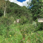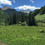
Capitol Creek Trail

Capitol Creek Trail

Connects: Capitol Creek Road (CR 9), Nickelson Creek Trail, Upper Capitol Creek Trail, Avalanche Creek Trail, West Snowmass Trail, Capitol Lake (11,600 ft) View Larger Map

Posted in 4-7 Miles, 7 Miles, Classic XC Skiing, Difficult, Dirt, Dog Friendly, Hard, Hiking, Horseback Riding, Maroon Bells-Snowmass Wilderness, Nordic (XC Ski), Old Snowmass, Running, Snow, Snowshoeing, Winter Trail Tagged with: , , , ,

Capitol Lake (11,600 ft)

Connects: Capitol Creek Trail Snowmass, CO – Lake Capitol Lake (11,600 ft) is an alpine lake in the Maroon Bells-Snowmass Wilderness accessed by the Capitol Creek Trail. More information about Capitol Lake can be found at: White River National Forest

Posted in Lake, Maroon Bells-Snowmass Wilderness, Old Snowmass, Sites, Snowmass Village

Capt. Will “Pyro” DuBois Memorial

Connects: Grand River Park, Grand River Park Loop New Castle, CO – Memorial The Capt. Will “Pyro” DuBois Memorial is a statue at Grand River Park honoring the fallen fighter pilot. News about the Capt. Will “Pyro” DuBois Memorial can

Posted in Memorial, New Castle, Sites

Carbonate Creek Trail

Carbonate Creek Trail

Connects: North Lost Trail, Avalanche Pass Trail, Arkansas Mountain Trail Marble, CO – Hard – 7 Miles – Hike, Run, Horseback Ride, Dog Friendly – Dirt Carbonate Creek Trail #1971 is a difficult trail you can hike, run, and horseback

Posted in 4-7 Miles, 7 Miles, Difficult, Dirt, Dog Friendly, Hiking, Horseback Riding, Marble, Maroon Bells-Snowmass Wilderness, Running, Trails

Carbondale Archery Range

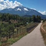
Connects: Delaney Nature Park Carbondale, CO – Archery Range The Carbondale Archery Range is a bow and arrow shooting range in the Delaney Nature Park in Carbondale, CO. View Larger Map
Posted in Carbondale, Shooting/Archery Range, Sites

Carbondale Climbing Boulder

Carbondale Climbing Boulder

Connects: Carbondale Recreation and Community Center Carbondale, CO – Climbing The Carbondale Climbing Boulder is a large rock feature next to the Carbondale Recreation and Community Center in Carbondale, CO. View Larger Map

Posted in Carbondale, Carbondale Parks, Climbing, Parks, Rock, Sites, Town

Carbondale to Crested Butte

Crystal Valley Trail

Connects: Highway 133 (West Elk Loop Scenic Byway), Crystal Valley Trail, Redstone (7,200 ft), Marble (8,000 ft), McClure Pass (8,755 ft), Kebler Pass (10,007 ft) Carbondale, CO – Hard – 74 Miles – Hike, Run, Mountain Bike, Horseback Ride, Dog

Posted in 8-10+ Miles, Carbondale, Crested Butte, Difficult, Dirt, Dog Friendly, Hard, Hiking, Horseback Riding, Large Loops/Backpacking, More Than 10 Miles, Mountain Biking, Paved, Road Biking, Running, Trails Tagged with: , , , ,

Cardiff Coke Ovens

Cardiff Coke Ovens

Connects: Cardiff Trail Glenwood Springs, CO – Coke Ovens The Cardiff Coke Ovens are a series of coke ovens in Glenwood Springs, CO. These coke ovens are listed on the National Register of Historic Places. More information about the Cardiff

Posted in Coke Ovens, Glenwood Springs, Historic, Sites

Cardiff Trail

Cardiff Coke Ovens Trail

Connects: Cardiff Coke Ovens Glenwood Springs, CO – Medium – Hike, Run, Mountain Bike, Dog Friendly – Dirt The Cardiff Trail is an intermediate/moderate trail you can hike, run and mountain bike that is dog friendly. This is a dirt

Posted in Dirt, Dog Friendly, Glenwood Springs, Hiking, Historic, Medium, Moderate, Mountain Biking, Running, Trails Tagged with:

Cascades (Grottos)

Grottos Trail

Connects: Grottos Trail, Ice Caves (Grottos) Aspen, CO – Waterfall The Cascades at the Grottos are a series of pools and waterfalls along black water-sculpted granite that flows down a section of the Roaring Fork River near Independence Pass. The

Posted in Aspen, Independence Pass, Sites, Water, Waterfall

Cascades (Rifle)

Rifle Cascades

Connects: Rifle Falls State Park, Bobcat Trail Rifle, CO – Waterfall The Rifle Cascades (6,820 ft) are a series of rocks with flowing water on East Rifle Creek at the Rifle Falls Fish Hatchery near Rifle Falls State Park. This

Posted in Rifle, Rifle Falls State Park, Sites, Water, Waterfall

Castle Creek Road (CR 15)

Castle Creek Road

Connects: Marolt Trail, Castle Creek Trail (Proposed), Congo Trail, Midnight Mine Road (FSR #118), Conundrum Creek Trail, Little Annie Road (CR 15G), American Lake Trail, Express Creek Road (FSR #122), Ashcroft Ghost Town, River Run Trail, King Cabin, Ashcroft Ski

Posted in 8-10+ Miles, Ashcroft, Ashcroft Ski Touring System, Aspen, Classic XC Skiing, Dog Friendly, Easy, Medium, Moderate, More Than 10 Miles, Nordic (XC Ski), Paved, Road Biking, Skate Skiing, Snow, Snowshoeing, Trails Tagged with: , ,

Castle Creek Trail (Proposed)

Castle Creek Trail

Connects: Marolt Trail, Castle Creek Road (CR 15), Aspen Country Day School, Aspen Music Festival and School Aspen, CO – Easy – 0.6 Miles – Walk, Run, Bike, Dog Friendly The Castle Creek Trail is a proposed trail to parallel

Posted in 1 Mile, 1-3 Miles, Aspen, Dog Friendly, Easy, Less Than A Mile, Paved, Road Biking, Running, Trails, Walking

Castle/Conundrum Peak Trail

Connects: Montezuma Basin Road (FSR #102), Castle Peak (14,279 ft), Conundrum Peak (14,040 ft) Ashcroft, CO – Hard – Hike -Rocky The Castle/Conundrum Peak Trail is a difficult trail you can hike to Castle Peak (14,279 ft) and Conundrum Peak

Posted in 4-7 Miles, Ashcroft, Aspen, Difficult, Hard, Hiking, Rocky, Trails

Cathedral Lake (11,865 ft)

Cathedral Lake

Connects: Cathedral Lake Trail, Electric Pass Trail Aspen, CO – Lake Cathedral Lake (11,865 ft) is an alpine lake at the base of Cathedral Peak in the Maroon Bells-Snowmass Wilderness accessed by the Cathedral Lake Trail that flows into Pine

Posted in Ashcroft, Aspen, Lake, Maroon Bells-Snowmass Wilderness, Sites Tagged with:

Trail Search

Find a trail. Use 1 or all 4 drop downs to customize your search for the right trail.

Dog Friendly:

  or  

Park Search

Find a park. Use the drop downs to find the perfect park.

Dog Friendly:

  or  

Featured and Mentioned On

Questions? Email us at info@aspentrailfinder.com
By using this site you agree to the terms of our User Agreement. Read our Disclaimer.