Castle/Conundrum Peak Trail

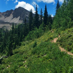
Connects: Montezuma Basin Road (FSR #102), Castle Peak (14,279 ft), Conundrum Peak (14,040 ft) Ashcroft, CO – Hard – Hike -Rocky The Castle/Conundrum Peak Trail is a difficult trail you can hike to Castle Peak (14,279 ft) and Conundrum Peak

Posted in 4-7 Miles, Ashcroft, Aspen, Difficult, Hard, Hiking, Rocky, Trails

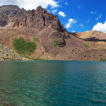
Cathedral Lake (11,865 ft)

Cathedral Lake

Connects: Cathedral Lake Trail, Electric Pass Trail Aspen, CO – Lake Cathedral Lake (11,865 ft) is an alpine lake at the base of Cathedral Peak in the Maroon Bells-Snowmass Wilderness accessed by the Cathedral Lake Trail that flows into Pine

Posted in Ashcroft, Aspen, Lake, Maroon Bells-Snowmass Wilderness, Sites Tagged with:

Cathedral Lake Trail

Cathedral Lake Trail

Connects: Castle Creek Road (CR 15), Cathedral Lake (11,866 ft), Electric Pass Trail Aspen, CO – Hard – 2.8 Miles – Hike, Run, Horseback Ride, Dog Friendly – Dirt Cathedral Lake Trail #1984 is a difficult trail you can hike,

Posted in 1-3 Miles, 3 Miles, Ashcroft, Aspen, Difficult, Dirt, Dog Friendly, Hard, Hiking, Horseback Riding, Maroon Bells-Snowmass Wilderness, Trails Tagged with: , , ,

Cattle Creek Loop

Cattle Creek Loop

Connects: Cattle Creek Road (CR 113), Crystal Springs Road (CR 112) Catherine Store Road (CR 100), Rio Grande Trail Carbondale, Glenwood Springs, CO – Medium – 20.5 Miles – Run, Hike, Road Bike, Mountain Bike – Paved/Gravel Cattle Creek Loop,

Posted in 8-10+ Miles, Carbondale, Glenwood Springs, Gravel, Large Loops/Backpacking, Medium, Moderate, More Than 10 Miles, Mountain Biking, Paved, Road Biking, Running, Trails Tagged with:

Cattle Creek Trail

Cattle Creek Trail

Connects: Upper Cattle Creek Road (FSR #509), Basalt Mountain Trail, Red Table Trail Basalt, CO – Medium – 3.7 Miles – Hike, Run, Mountain Bike, Horseback Ride, Dog Friendly – Dirt Cattle Creek Trail #1909 is an intermediate/moderate trail you

Posted in 1-3 Miles, 4 Miles, Basalt, Carbondale, Dirt, Dog Friendly, El Jebel, Hiking, Horseback Riding, Medium, Moderate, Mountain Biking, Running, Trails

Cayton Ranger Station

Connects: Forest Service Road #800, Cayton Gulch Trail, Lake Fork Trail Silt, CO – Historic The Cayton Ranger Station, formerly known as the Johnson Springs Ranger Station and also called the Cayton Guard Station, is the second oldest ranger station

Posted in Historic, Rifle, Sites Tagged with: , ,

Cedar Drive

Cedar Drive

Connects: Sopris Drive, Central Rocky Mountain Permaculture Institute, Old Wagon Road Basalt, CO – Medium – Hike, Run, Road Bike, Mountain Bike – Paved/Dirt Cedar Drive is an intermediate/moderate road you can hike, run, road and mountain bike. This is

Posted in 1-3 Miles, 2 Miles, Basalt, Dirt, Hiking, Medium, Moderate, Mountain Biking, Paved, Road Biking, Running, Trails

Cell Tower Road

Cell Tower Road

Connects: Basalt State Wildlife Area, Lake Christine, Kelly Lake Road Basalt, CO – Medium – Hike, Run – Dirt Cell Tower Road is an intermediate/moderate area you can hike and run. Winter closure Dec. 1 to April 15. Hunting takes

Posted in 1-3 Miles, Basalt, Basalt State Wildlife Area, Dirt, Hiking, Medium, Moderate, Running, Trails

Cemetery Lane Trail

Cemetery Lane Trail

Connects: ABC Trail, Bugsy Barnard Park, Red Butte Cemetery, Tot Lot Park, Red Butte Trail, Slaughterhouse Bridge (Cemetery Lane Bridge), Rio Grande Trail, Stein Park, McLain Flats Road (CR 19) View Larger Map View Larger Map

Posted in 1 Mile, 1-3 Miles, Aspen, Dog Friendly, Easy, Fat Biking, Paved, Road Biking, Running, Snow, Trails, Walking, Winter Trail Tagged with:

Centennial Park (New Castle)

Centennial Park

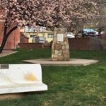
Connects: Main Street New Castle, CO – Park Centennial Park is a small area along Main Street in New Castle, CO. This park includes: Bench Monument to the community View Larger Map

Posted in Bench, Dog Friendly, New Castle, Parks

Chaparral Ranch Trail

Chaparral Ranch Trail

Connects: Upper River Road (CR 17) Woody Creek, CO – Medium – 3.5 Miles – Hike, Run, Mountain Bike – Dirt Chaparral Ranch Trail is an intermediate/moderate dirt trail you can hike, run and mountain bike. Dogs are not allowed

Posted in 3 Miles, 4-7 Miles, Aspen, Dirt, Hiking, Medium, Moderate, Mountain Biking, Running, Trails, Woody Creek

Chapman Gulch Road (FSR #504E)

Chapman Gulch Road (FSR #504E)

Connects: Norrie Road (FSR #504), Chapman Lake Trail, Chapman Gulch Trail Norrie, CO – Medium – 2.4 Miles – Hike, Run, Mountain Bike, Horseback Ride, Dog Friendly – Dirt Chapman Gulch Road (FSR #504E) is an intermediate/moderate road you can

Posted in 1-3 Miles, 3 Miles, Basalt, Dirt, Dog Friendly, Hiking, Horseback Riding, Medium, Meredith, Moderate, Mountain Biking, Nast, Norrie, Running, Thomasville, Trails

Chapman Gulch Trail

Chapman Gulch Trail

Connects: Chapman Gulch Road (FSR #504E) Norrie, CO – Medium – 5.2 Miles – Hike, Run, Horseback Ride, Dog Friendly – Dirt Chapman Gulch Trail #1920 is an intermediate/moderate trail you can hike, run, and horseback ride that is dog

Posted in 4-7 Miles, 5 Miles, Basalt, Dirt, Dog Friendly, Hiking, Horseback Riding, Hunter-Fryingpan Wilderness, Medium, Moderate, Norrie, Running, Trails

Chapman Lake (9,785 ft)

Chapman Lake

Connects: Chapman Lake Trail, South Fork Fryingpan Trail Nast, CO – Lake Chapman Lake (9,785 ft) is a lake near Nast accessed by Chapman Lake Trail in the Hunter-Fryingpan Wilderness. View Larger Map

Posted in Hunter-Fryingpan Wilderness, Lake, Nast, Sites

Chapman Lake Trail

Chapman Lake Trail

Connects: Chapman Gulch Road (FSR #504E), Chapman Lake (9,785 ft) Meredith, CO – Easy – 0.7 Miles – Hike, Dog Friendly – Dirt Chapman Lake Trail is an easy trail you can hike that is dog friendly. This is a

Posted in 1-3 Miles, Basalt, Dirt, Dog Friendly, Easy, Hiking, Hunter-Fryingpan Wilderness, Less Than A Mile, Meredith, Norrie, Ruedi Reservoir, Trails

Trail Search

Find a trail. Use 1 or all 4 drop downs to customize your search for the right trail.

Dog Friendly:

  or  

Park Search

Find a park. Use the drop downs to find the perfect park.

Dog Friendly:

  or  

Featured and Mentioned On

Questions? Email us at info@aspentrailfinder.com
By using this site you agree to the terms of our User Agreement. Read our Disclaimer.