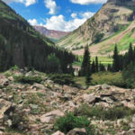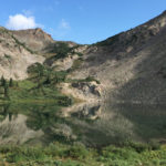
Copper Lake (11,320 ft)

Copper Lake

Connects: Copper Creek Trail, East Maroon Trail, Triangle Pass Trail Gothic, CO – Lake Copper Lake (11,320 ft) is an alpine lake just below East Maroon Pass (11,820 ft) in the Maroon Bells-Snowmass Wilderness accessed primarily by the Copper Creek

Posted in Crested Butte, Gothic, Lake, Maroon Bells-Snowmass Wilderness, Sites

Cottonwood Pass (8,290 ft)

Cottonwood Pass Road

Connects: Cottonwood Pass Road (CR 10A) Carbondale, CO – Mountain Pass Cottonwood Pass (8,290 ft) is a mountain pass accessed by Cottonwood Pass Road (CR 10A) near Carbondale, CO. There are no signs that mark the peak of Cottonwood Pass.

Posted in Carbondale, Mountain Pass, Road Biking, Running, Sites

Cottonwood Pass Road (CR 10A)

Cottonwood Pass Road

Connects: Cattle Creek Road (CR 113), Cottonwood Pass (8,290 ft), Red Table Road (FSR #514)

Posted in 4-7 Miles, 8-10+ Miles, Carbondale, Classic XC Skiing, Dirt, Dog Friendly, Easy, Fat Biking, Medium, Moderate, More Than 10 Miles, Mountain Pass, Nordic (XC Ski), Paved, Road Biking, Running, Snow, Snowshoeing, Trails, Winter Trail

Coyote Trail

Coyote Trail

Connects: Rifle Falls State Park, Rifle Falls (6,550 ft), Mountain Mist Amphitheater, Rifle Falls Caves, Bobcat Trail, Squirrel Trail Rifle, CO – Easy – 2 Miles – Hike, Dog Friendly – Paved/Dirt The Coyote Trail is an easy trail you

Posted in 1-3 Miles, 2 Miles, Dirt, Dog Friendly, Easy, Hiking, Paved, Rifle, Rifle Falls State Park, Trails

Cozy Point Archery Range

Cozy Point Archery Range

Connects: Cozy Point Open Space, Cozy Point Trail Aspen, CO – Archery Range Cozy Point Archery Range is a bow and arrow shooting range in the Cozy Point Open Space in Aspen near Woody Creek, CO. View Larger Map

Posted in Aspen, Shooting/Archery Range, Sites

Cozy Point Trail

Cozy Point Trail

Connects: Cozy Point Open Space, Cozy Point Archery Range Aspen, CO – Medium – 1.1 Miles – Hike, Run, Horseback Ride – Dirt Cozy Point Trail is an intermediate/moderate trail you can hike, run, and horseback ride. Dogs are not

Posted in 1 Mile, 1-3 Miles, Aspen, Dirt, Hiking, Horseback Riding, Medium, Moderate, Running, Trails, Woody Creek

Cozy Pony Trail

Cozy Pony Trail

Connects: Brush Creek Trail, Cozyline Trail, Sky Mountain Park Snowmass Village, CO – Easy – 0.5 Miles – Hike, Run, Mountain Bike, Horseback Ride – Dirt Cozy Pony Trail is an easy trail you can hike, run, mountain bike, and

Posted in 1-3 Miles, Dirt, Easy, Hiking, Horseback Riding, Less Than A Mile, Mountain Biking, Running, Sky Mountain Park, Snowmass Village, Trails

Cozyline Trail

Cozyline Trail

Connects: Sky Mountain Park, Brush Creek Trail, Cozy Pony Trail, Airline Trail, Skyline Ridge Trail Aspen, Snowmass, CO – Medium – 2.8 Miles – Hike, Run, Mountain Bike – Dirt Cozyline Trail is an intermediate/moderate trail you can hike, run,

Posted in 1-3 Miles, 3 Miles, Aspen, Dirt, Hiking, Medium, Moderate, Mountain Biking, Running, Sky Mountain Park, Snowmass Village, Trails Tagged with:

Crater Lake (10,076 ft)

Crater Lake

Connects: Four Pass Loop, Crater Lake Trail, Maroon-Snowmass Trail, West Maroon Trail Aspen, CO – Lake Crater Lake (10,076 ft) is an alpine lake in the Maroon Bells-Snowmass Wilderness accessed by the Crater Lake Trail (a section of the Maroon-Snowmass

Posted in Aspen, Lake, Maroon Bells-Snowmass Wilderness, Sites, Water Tagged with: , ,

Crater Lake Trail

Crater Lake Trail

Connects: Maroon Lake (9,585 ft), Maroon Bells Scenic Trail, West Maroon Portal Trail, Four Pass Loop, Maroon-Snowmass Trail, West Maroon Trail, Crater Lake (10,076 ft) Aspen, CO – Medium – 1.8 Miles – Hike, Run, Dog Friendly – Rocky/Dirt Crater

Posted in 1-3 Miles, 2 Miles, Aspen, Dirt, Dog Friendly, Hiking, Maroon Bells-Snowmass Wilderness, Medium, Moderate, Rocky, Running, Trails Tagged with: ,

Creekside Trail

Creekside Trail

Connects: Prince Creek, Prince Creek Road (CR 5, 111), Skill Saw Trail Carbondale, CO – Medium – 1 Mile – Hike, Run, Mountain Bike, Dog Friendly – Dirt Creekside Trail is an intermediate/moderate trail you can hike, run and mountain

Posted in 1 Mile, 1-3 Miles, Basalt, Carbondale, Dirt, Dog Friendly, Hiking, Medium, Moderate, Mountain Biking, Prince Creek Trail System, Running, The Crown, Trails

Crooked Creek Pass (10,009 ft)

Crooked Creek Pass

Connects: Eagle-Thomasville Road (FSR #400), Mount Thomas Trail Thomasville, CO – Mountain Pass Crooked Creek Pass (10,009 ft) is a mountain pass along Eagle-Thomasville Road (FSR #400) near Basalt, CO. Distances: Crooked Creek Pass to Thomasville – 12 Miles Crooked

Posted in Basalt, Meredith, Mountain Pass, Nast, Sites, Thomasville Tagged with:

Cross Mountain Trail (Trestle)

Connects: Snowmass Bike Park, Elk Camp Meadows Loop, Elk Camp Gondola Snowmass Village, CO – Medium – 2.2 Miles – Mountain Bike – Dirt Cross Mountain Trail, also called Trestle, is an intermediate/moderate mountain biking trail in Snowmass Village, CO.

Posted in 1-3 Miles, 2 Miles, Dirt, Medium, Moderate, Mountain Biking, Snowmass Village, Trails Tagged with:

Cross Trail

Connects: Red Mountain Trail (Jeanne Golay Trail/Red Mountain Road, Fall Line Trail, Grandstaff Trail, Red Mountain Cross (7,450 ft) News about the Cross Trail can be found at: Post Independent (November 12, 2017) – Red Mountain trail safety measures taken

Posted in 1 Mile, 1-3 Miles, Difficult, Dirt, Dog Friendly, Glenwood Springs, Hard, Hiking, Mountain Biking, Red Mountain Glenwood Springs, Running, Trails

Crown Mountain Park Loop

Crown Mountain Park Loop

Connects: Crown Mountain Park, Crown Mountain River Trail View Larger Map

Posted in 1 Mile, 1-3 Miles, Basalt, Classic XC Skiing, Dog Friendly, Easy, El Jebel, Fat Biking, Nordic (XC Ski), Paved, Road Biking, Running, Skate Skiing, Snow, Snowshoeing, Trails, Walking, Winter Trail

Trail Search

Find a trail. Use 1 or all 4 drop downs to customize your search for the right trail.

Dog Friendly:

  or  

Park Search

Find a park. Use the drop downs to find the perfect park.

Dog Friendly:

  or  

Featured and Mentioned On

Questions? Email us at info@aspentrailfinder.com
By using this site you agree to the terms of our User Agreement. Read our Disclaimer.