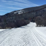
Connects: Spring Gulch, North Star Trail (XC Only), Highball Trail (XC Only), Paul’s Point, Out & Back Trail (XC Only) Carbondale, CO – Medium – 2.11 KM (1.31 Miles) – Classic XC Ski, Skate Ski – Snow Finlandia Trail is…
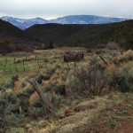
Connects: Cattle Creek Road (CR 113), Red Canyon Road (CR 115), Fisher Cemetery Road (CR 62), Fisher Cemetery The Fisher Creek area, or Haff Pasture, is a Special Management Area with numerous routes and trails near Carbondale and Glenwood Springs,…
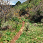
Connects: Boy Scout Loop, Scout Trail, Bear Creek, Hubbard Cave Road (FSR #408) Glenwood Springs, CO – Hard – 5 Miles – Hike, Run, Mountain Bike, Dog Friendly – Dirt Forest Hollow Trail is a difficult trail you can hike,…
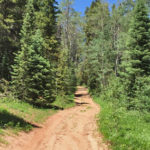
Connects: Arbaney Traverse, Four Corners (9,785 ft), Lenado Trail (Tincup/Tinpot Trail), Hobbit Trail, Secret Trail (Sunnyside Trail), Red Mountain Road (FSR #130.3), Van Horn Lookout Trail, Van Horn Park (9,900 ft) Aspen, CO – Medium – 1 Mile – Hike,…
Connects: Midland Ave, Dry Park Road (CR 125), Sunlight Mountain, Four Mile Road (FSR #300) Glenwood Springs, CO – Medium – Road Bike – Paved Four Mile Road (CR 117) is an intermediate/moderate road you can bike. This is a…
Connects: Four Mile Road (CR 117), Sunlight Mountain, Sunlight Peak Road (FSR #318), Sunlight to Powderhorn Trail (Winter), Four Mile Park, Beaver Creek Trail Distances: Four Mile Road (CR 117) to Four Mile Road (FSR #300) – 9.5 Miles Start…

Connects: Aspen to Crested Butte, Marble to Crested Butte, Three Pass Loop, Maroon Lake (9,585 ft), Maroon Bells Scenic Trail, Maroon-Snowmass Trail, Crater Lake Trail, Crater Lake (10,076 ft), West Maroon Trail, West Maroon Pass (12,465 ft), Frigid Air Pass…
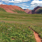
Connects: Four Pass Loop, North Fork Cutoff Trail, Geneva Lake Trail, Love’s Cabin, Hasley Basin Trail, Fravert Basin, Frigid Air Pass (12,405 ft), West Maroon Trail Marble, CO – Hard – 8 Miles – Hike, Run, Horseback Ride, Dog Friendly…