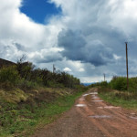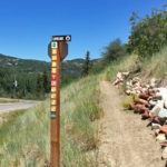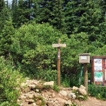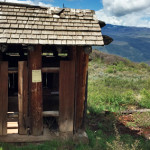
Lookout Mountain Park (7,950 ft)

Lookout Mountain Park

Connects: Scout Trail, Lookout Mountain Road (CR 120) Glenwood Springs, CO – Viewing Area Lookout Mountain Park (7,950 ft) is a site that includes picnic tables and a historic outhouse at the bottom of the radio towers on Lookout Mountain

Posted in Glenwood Springs, Historic, Recreation Area, Sites, Viewing Area

Lookout Mountain Road (CR 120)

Lookout Mountain Road

Connects: Boy Scout Loop, Hubbard Cave Road (FSR #408), Lookout Mountain Park, Scout Trail Glenwood Springs, CO – Medium – 5.5 Miles – Hike, Run, Mountain Bike, Dog Friendly – Dirt Lookout Mountain Road (CR 120) is an intermediate/moderate trail

Posted in 4-7 Miles, 5 Miles, Dog Friendly, Glenwood Springs, Hiking, Lookout Moutain, Medium, Moderate, Mountain Biking, Running, Trails

Lorax Trail

Lorax Trail

Connects: Thompson Creek Road (CR 108) Carbondale, CO – Medium – 3 Miles (Round Trip) – Hike, Run, Mountain Bike, Dog Friendly – Dirt The Lorax Trail is an intermediate/moderate trail you can hike, run, and mountain bike that is

Posted in 1-3 Miles, Carbondale, Dirt, Dog Friendly, Hiking, Medium, Moderate, Mountain Biking, Running, Trails

Lost Man Lake (12,450 ft)

Lost Man Lake

Connects: Lost Man Trail, Lost Man Pass (12,805 ft) Aspen, CO – Lake Lost Man Lake (12,450 ft) is an alpine lake in the Hunter-Fryingpan Wilderness accessed by the Lost Man Trail. More information about Lost Man Lake can be

Posted in Aspen, Hunter-Fryingpan Wilderness, Independence Pass, Lake, Sites, Water Tagged with:

Lost Man Loop

Lost Man Trail

Connects: Independence Pass Road (HWY 82), Lost Man Campground, Lost Man Trail, Midway Creek Trail, Lost Man Reservoir (10,580 ft) , South Fork Pass Trail, Lost Man Lake (12,450 ft), Lost Man Pass (12,805 ft), Independence Lake (12,497 ft), Linkins

Posted in 8-10+ Miles, Difficult, Dog Friendly, Expert, Hiking, Horseback Riding, Large Loops/Backpacking, More Than 10 Miles, Road Biking, Running, Trails

Lost Man Pass (12,805 ft)

Lost Man Pass

Connects: Lost Man Trail, Independence Lake (12,497 ft), Lost Man Lake (12,450 ft) Aspen, CO – Mountain Pass Lost Man Pass (12,805 ft) is a high mountain pass between Independence Lake (12,497 ft) and Lost Man Lake (12,450 ft) along

Posted in Aspen, Hunter-Fryingpan Wilderness, Mountain Pass, Sites

Lost Man Reservoir (10,580 ft)

Lost Man Reservoir

Connects: Lost Man Trail, Midway Creek Trail Aspen, CO – Reservoir Lost Man Reservoir (10,580 ft) is a 30- to 40-acre-foot earthen-bottom reservoir on Lost Man Creek near Independence Pass in Aspen, CO. Lost Man Reservoir is accessed along the

Posted in Aspen, Independence Pass, Reservoir, Sites, Water Tagged with:

Lost Man Trail

Lost Man Trail

Connects: Lost Man Loop, Independence Pass Road (HWY 82), Lost Man Campground, Midway Creek Trail, Lost Man Reservoir (10,580 ft) , South Fork Pass Trail, Lost Man Lake (12,450 ft), Lost Man Pass (12,805 ft), Independence Lake (12,497 ft), Linkins

Posted in 8-10+ Miles, 9 Miles, Aspen, Difficult, Dirt, Dog Friendly, Hard, Hiking, Horseback Riding, Hunter-Fryingpan Wilderness, Independence Pass, Large Loops/Backpacking, Rocky, Running, Trails Tagged with: , , ,

Lower Ice Cave

Lower Ice Cave

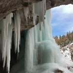
Connects: Koper’s Trail, Upper Ice Cave Rifle, CO – Ice Cave The Lower Ice Cave is an open area of rock where ice covers the front to create an ice cave. This is a winter site found along Koper’s Trail

Posted in Cave, Ice, Ice Cave, Rifle, Rifle Mountain Park, Sites, Snow, Snowshoeing, Winter Site Tagged with: ,

Lower Sunshine Trail

Connects: Sunshine Trail Glenwood Springs, CO – Easy – Snowshoe, Classic XC Ski, Skate Ski, Dog Friendly – Snow Lower Sunshine Trail is an easy winter trail you can snowshoe, classic cross-country ski and skate ski that is dog friendly.

Posted in 1-3 Miles, Classic XC Skiing, Dog Friendly, Easy, Glenwood Springs, Nordic (XC Ski), Nordic Centers and Systems, Nordic Trail, Skate Skiing, Snow, Snowshoeing, Trails, Winter Trail

Lower Valley Trail (LoVa Trail)

LoVa Trail

Connects: South Canyon, South Canyon Bridge, South Canyon Archery Range, South Canyon Creek Road (CR 134) Glenwood Springs, CO – Easy – 50 Miles – Paved The Lower Valley Trail, or LoVa Trail, is a proposed 50-mile path along the

Posted in Dog Friendly, Glenwood Springs, New Castle, Rifle, Trails Tagged with: ,

Lowline Trail

Lowline Trail

Connects: Sky Mountain Park, Highline Trail Snowmass Village, CO – Easy – 1 Mile – Hike, Run, Mountain Bike, Dog Friendly – Dirt Lowline Trail is an easy trail you can hike, run, and mountain bike that is dog friendly.

Posted in 1 Mile, 1-3 Miles, Dirt, Dog Friendly, Easy, Hiking, Mountain Biking, Running, Sky Mountain Park, Snowmass Village, Trails

Luchsinger Halfway House

Luchsinger Halfway House

Connects: Basalt History Tour Basalt, CO – Historic Building The Luchsinger Halfway House is an old house in Basalt, CO. This a site along the Basalt Historical Walking Tour. More information about the Luchsinger Halfway House can be found at:

Posted in Basalt, Historic, Sites Tagged with:

Lyle Lake (11,375 ft)

Lyle Lake

Connects: Lyle/Mormon Lake Trail Nast, CO – Lake Lyle Lake (11,375 ft) is an alpine lake in the Holy Cross Wilderness accessed by the Lyle Lake Trail. This is a lake near Hagerman Pass. More information about the Lyle Lake

Posted in Holy Cross Wilderness, Lake, Meredith, Nast, Norrie, Sites

Lyle/Mormon Lake Trail

Lyle/Mormon Lakes Trail

Connects: Hagerman Pass Road (FSR #105), Lyle Lake (11,375 ft), Mormon Lake (11,465 ft) Nast, CO – Medium – 3.3 Miles – Hike, Run, Horseback Ride, Dog Friendly – Dirt Lyle/Mormon Lake Trail #1919, also called Lyle Lake Trail or

Posted in 1-3 Miles, 3 Miles, Basalt, Dirt, Dog Friendly, Hiking, Holy Cross Wilderness, Horseback Riding, Medium, Meredith, Moderate, Norrie, Running, Trails Tagged with: ,

Trail Search

Find a trail. Use 1 or all 4 drop downs to customize your search for the right trail.

Dog Friendly:

  or  

Park Search

Find a park. Use the drop downs to find the perfect park.

Dog Friendly:

  or  

Featured and Mentioned On

Questions? Email us at info@aspentrailfinder.com
By using this site you agree to the terms of our User Agreement. Read our Disclaimer.