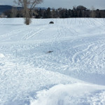
RVR Sledding Hill

RVR Sledding Hill

Connects: River Valley Ranch Carbondale, CO – Sled, Dog Friendly – Snow The RVR Sledding Hill is a series of hills on the River Valley Ranch Golf Course practice range that you can sled down that are dog friendly. This

Posted in Carbondale, Sites, Sledding Hill, Snow, Winter Site Tagged with:

Sage Loop Trail

Connects: Red Hill, Northside Loop Trail Carbondale, CO – Easy – 1.3 Miles – Hike, Run, Mountain Bike, Dog Friendly – Dirt Sage Loop Trail is an easy trail you can hike, run, and mountain bike that is dog friendly.

Posted in 1 Mile, 1-3 Miles, Carbondale, Dirt, Dog Friendly, Easy, Hiking, Mountain Biking, Running, Trails Tagged with:

Sam’s Knob Uphill Route

Connects: Sam’s Knob Lift Snowmass Village, CO – Hard – Uphill, Snowshoe, Dog Friendly – Snow Sam’s Knob Uphill Route is a difficult route you can skin and snowshoe up that is dog friendly. This is an uphill route on

Posted in 1-3 Miles, Dog Friendly, Hard, Skinning, Snow, Snowmass Ski Area, Snowshoeing, Trails, Uphilling (SkiMo), Winter Trail

Satank Bridge

Satank Bridge

Connects: Roaring Fork River, Rio Grande Trail Carbondale, CO – Bridge Satank Bridge is a historic bridge built in 1900 over the Roaring Fork River that connects with the Rio Grande Trail near Carbondale, CO. The bridge is listed on

Posted in Bridge, Carbondale, Historic, Sites

Savage Lakes (11,050 ft)

Savage Lakes

Connects: Savage Lakes Trail Thomasville, CO – Lake Savage Lakes (11,050 ft) are a couple alpine lakes in the Holy Cross Wilderness accessed by the Savage Lakes Trail. These are lakes near Thomasville, CO. More information about Savage Lakes Trail

Posted in Basalt, Holy Cross Wilderness, Lake, Meredith, Nast, Norrie, Sites, Thomasville Tagged with:

Savage Lakes Trail

Savage Lakes Trail

Connects: North Fork Road (FSR #501), Savage Lakes (11,050 ft), Henderson Park Trail Thomasville, CO – Medium – 2 Miles – Hike, Run, Horseback Ride, Dog Friendly – Dirt Savage Lakes Trail #1918 is an intermediate/moderate trail you can hike,

Posted in 1-3 Miles, 2 Miles, Basalt, Dirt, Dog Friendly, Hiking, Holy Cross Wilderness, Horseback Riding, Medium, Meredith, Moderate, Nast, Norrie, Running, Thomasville, Trails Tagged with:

Sawyer Lake (11,025 ft)

Connects: Sawyer Lake Trail Nast, CO – Lake Sawyer Lake (11,025 ft) is a lake near Nast accessed by Sawyer Lake Trail in the Hunter-Fryingpan Wilderness. View Larger Map

Posted in Hunter-Fryingpan Wilderness, Lake, Nast, Sites

Sawyer Lake Trail

Sawyer Lake Trail

Connects: Twin Meadows (9,465 ft), Sawyer Lake (11,025 ft) Norrie, CO – Medium – 4.7 Mile – Hike, Run, Horseback Ride, Dog Friendly – Dirt Sawyer Lake Trail #1926 is an intermediate/moderate trail you can hike, run, and horseback ride

Posted in 4-7 Miles, 5 Miles, Basalt, Dirt, Dog Friendly, Hiking, Horseback Riding, Hunter-Fryingpan Wilderness, Medium, Meredith, Moderate, Nast, Norrie, Running, Trails

Schofield Pass (10,700 ft)

Aspen Trail Finder App

Connects: Marble to Crested Butte, Schofield Pass Road (FSR #317), Gothic Road (FSR #317), Trailriders Trail Gothic, CO – Mountain Pass Schofield Pass (10,700 ft) is a mountain pass in the Sawatch Range that connects Marble to Crested Butte in

Posted in Crested Butte, Gothic, Marble, Mountain Pass, Sites

Schofield Pass Road (FSR #317)

Connects: Lead King Loop, Lead King Basin Road (FSR #315), Crystal City Road (FSR #314), Crystal Bridge No. 4, Devil’s Punchbowl (Schofield Pass), Schofield Park, West Maroon Trail, Schofield Pass (10,700 ft) Marble, CO – Hard – 8 Miles –

Posted in 8 Miles, 8-10+ Miles, Crested Butte, Difficult, Dog Friendly, Expert, Hard, Hiking, Marble, Mountain Biking, Rocky, Running, Trails Tagged with: , , ,

Scout Trail

Scout Trail

Connects: Boy Scout Loop, Artist Point (6,540 ft), Forest Hollow Trail, Lookout Mountain Park, Lookout Mountain Road (CR 120) Glenwood Springs, CO – Hard – Hike, Run, Mountain Bike, Dog Friendly – Dirt The Scout Trail, also referred to as

Posted in 1-3 Miles, 4-7 Miles, 8-10+ Miles, Difficult, Dirt, Dog Friendly, Glenwood Springs, Hard, Hiking, More Than 10 Miles, Mountain Biking, Running, Trails Tagged with: ,

Secret Trail (Sunnyside Trail)

Secret Trail

Connects: Sunnyside Trail, Plunge Trail (Sunnyside Trail), Four Corners (9,785 ft), Four Corners Road (20B.1), Van Horn Trail, Lenado Trail (Tincup/Tinpot Trail), Red Mountain Road (FSR 130.3) Aspen, CO – Medium – 1.5 Miles – Hike, Run, Mountain Bike, Horseback

Posted in 1-3 Miles, Aspen, Dirt, Dog Friendly, Hiking, Horseback Riding, Less Than A Mile, Medium, Moderate, Mountain Biking, Running, Trails Tagged with:

Sellar Coke Ovens

Sellar Coke Ovens

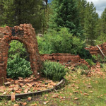
Connects: Hagerman Pass Road (FSR #105), Sellar Meadow (9,630 ft) Nast, CO – Coke Ovens The Sellar Coke Ovens are ruins of charcoal kilns that were built for refining charcoal. This is a site in Sellar Meadow, part of the

Posted in Basalt, Coke Ovens, Meredith, Nast, Norrie, Sites Tagged with: , ,

Sellar Meadow (9,630 ft)

Sellar Meadow

Connects: Hagerman Pass Road (FSR #105), Sellar Coke Ovens Nast, CO – Meadow Sellar Meadow (9,630 ft), also called Sellar Park, is a meadow that is part of the Coke Oven State Wildlife Area along Hagerman Pass Road (FSR #105)

Posted in Basalt, Meredith, Nast, Norrie, Sites, Viewing Area

Sequel Trail

Connects: Tom Blake Trail, Government Trail, Snowmass Bike Park Snowmass Village, CO – Medium – 0.6 Miles – Hike, Mountain Bike, Dog Friendly – Dirt Sequel Trail is an intermediate/moderate trail you can hike and mountain bike that is dog

Posted in 1-3 Miles, Dirt, Dog Friendly, Hiking, Less Than A Mile, Medium, Moderate, Mountain Biking, Snowmass Village, Trails Tagged with:

Trail Search

Find a trail. Use 1 or all 4 drop downs to customize your search for the right trail.

Dog Friendly:

  or  

Park Search

Find a park. Use the drop downs to find the perfect park.

Dog Friendly:

  or  

Featured and Mentioned On

Questions? Email us at info@aspentrailfinder.com
By using this site you agree to the terms of our User Agreement. Read our Disclaimer.