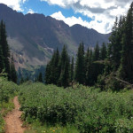
Little Grand Mesa Road (FSR #535)

Connects: Hubbard Cave Road (FSR #408) Glenwood Springs, CO – Medium – 10 Miles – Hike, Mountain Bike, Dog Friendly – Dirt Little Grand Mesa Road (FSR #535), also called Landis Creek Road, is an intermediate/moderate route you can hike

Posted in 10 Miles, 8-10+ Miles, Dirt, Dog Friendly, Glenwood Springs, Hiking, Medium, Moderate, Mountain Biking, Trails

Little Nell Trail

Connects: Aspen Mountain Summer Road (Aspen Mountain Trail), AJAX Trail, West Side Trail, Power of 1 Trail Aspen, CO – Hard – 1.5 Miles – Hike, Run, Mountain Bike, Dog Friendly – Dirt The Little Nell Trail is a difficult

Posted in 1-3 Miles, 2 Miles, Aspen, Aspen Mountain (AJAX), Dirt, Dog Friendly, Hard, Hiking, Mountain Biking, Running, Trails

Lone Pine Trail

Lone Pine Trail

Connects: North Fork Trail Basalt, CO – Medium – Hike, Run, Mountain Bike, Horseback Ride, Dog Friendly – Dirt Lone Pine Trail #1913 is an intermediate/moderate trail you can hike, run, mountain bike, and horseback ride that is dog friendly.

Posted in Basalt, Basalt Mountain, Dirt, Dog Friendly, Hiking, Horseback Riding, Medium, Moderate, Mountain Biking, Running, Trails

Lorax Trail

Lorax Trail

Connects: Thompson Creek Road (CR 108) Carbondale, CO – Medium – 3 Miles (Round Trip) – Hike, Run, Mountain Bike, Dog Friendly – Dirt The Lorax Trail is an intermediate/moderate trail you can hike, run, and mountain bike that is

Posted in 1-3 Miles, Carbondale, Dirt, Dog Friendly, Hiking, Medium, Moderate, Mountain Biking, Running, Trails

Lost Man Trail

Lost Man Trail

Connects: Lost Man Loop, Independence Pass Road (HWY 82), Lost Man Campground, Midway Creek Trail, Lost Man Reservoir (10,580 ft) , South Fork Pass Trail, Lost Man Lake (12,450 ft), Lost Man Pass (12,805 ft), Independence Lake (12,497 ft), Linkins

Posted in 8-10+ Miles, 9 Miles, Aspen, Difficult, Dirt, Dog Friendly, Hard, Hiking, Horseback Riding, Hunter-Fryingpan Wilderness, Independence Pass, Large Loops/Backpacking, Rocky, Running, Trails Tagged with: , , ,

Lowline Trail

Lowline Trail

Connects: Sky Mountain Park, Highline Trail Snowmass Village, CO – Easy – 1 Mile – Hike, Run, Mountain Bike, Dog Friendly – Dirt Lowline Trail is an easy trail you can hike, run, and mountain bike that is dog friendly.

Posted in 1 Mile, 1-3 Miles, Dirt, Dog Friendly, Easy, Hiking, Mountain Biking, Running, Sky Mountain Park, Snowmass Village, Trails

Lyle/Mormon Lake Trail

Lyle/Mormon Lakes Trail

Connects: Hagerman Pass Road (FSR #105), Lyle Lake (11,375 ft), Mormon Lake (11,465 ft) Nast, CO – Medium – 3.3 Miles – Hike, Run, Horseback Ride, Dog Friendly – Dirt Lyle/Mormon Lake Trail #1919, also called Lyle Lake Trail or

Posted in 1-3 Miles, 3 Miles, Basalt, Dirt, Dog Friendly, Hiking, Holy Cross Wilderness, Horseback Riding, Medium, Meredith, Moderate, Norrie, Running, Trails Tagged with: ,

Mansfield Ditch Trail

Mansfield Ditch Trail

Connects: Buford-New Castle Road (FSR #245), Cherry Creek Trail, Forest Service Road #820, Forest Service Road #819, Spring Cow Camp Cabin, Deep Creek Canyon, Calhoun Basin New Castle, CO – Medium – 9.5 Miles – Hike, Run, Mountain Bike, Horseback

Posted in 8-10+ Miles, 9 Miles, Dirt, Dog Friendly, Hiking, Horseback Riding, Medium, Moderate, Mountain Biking, New Castle, Rifle, Running, Trails

Marble Quarry Road (CR 3C)

Marble Quarry Road

Connects: Gunnison County Road 3, Marble Mill Site Park, Marble Disc Golf Course, Crystal River, Raspberry Creek Trail, Yule Pass Trail, Yule Marble Quarry Marble, CO – Hard – 3.1 Miles – Hike, Run, Mountain Bike – Dirt Marble Quarry

Posted in 1-3 Miles, 3 Miles, Difficult, Dirt, Hiking, Marble, Mountain Biking, Running, Trails

Marble to Crested Butte

Marble to Crested Butte

Connects: Aspen to Marble, Marble, Beaver Lake (7,945 ft), Four Pass Loop, Lead King Loop, Hasley Pass (12,144 ft), Frigid Air Pass (12,405 ft), Schofield Pass (10,700 ft), Yule Pass (11,300 ft) Marble, Crested Butte, CO – Hard – Hike,

Posted in 8-10+ Miles, Crested Butte, Difficult, Dirt, Dog Friendly, Gothic, Hard, Hiking, Horseback Riding, Large Loops/Backpacking, Marble, Maroon Bells-Snowmass Wilderness, More Than 10 Miles, Mountain Biking, Raggeds Wilderness, Running, Trails

Marion Gulch Trail

Marion Gulch Trail

Connects: Thompson Creek Road (CR 108), Marion Cemetery Road (CR 123), Marion Cemetery, Sunlight to Powderhorn Trail (Winter) View Larger Map

Posted in Carbondale, Classic XC Skiing, Dirt, Dog Friendly, Hiking, Horseback Riding, Medium, Moderate, Nordic (XC Ski), Running, Snow, Snowshoeing, Trails, Winter Trail Tagged with:

Maroon Bells Scenic Trail

Maroon Bells Scenic Trail

Connects: Maroon Creek Road (CR 13), Maroon Lake (9,585 ft), Maroon Creek Trail (Maroon Bells), Maroon Bells Scenic Area, West Maroon Portal Trail, Four Pass Loop, Crater Lake Trail, Maroon-Snowmass Trail Printable Maroon Bells Trail Map Aspen, CO – Easy

Posted in 1 Mile, 1-3 Miles, Aspen, Dirt, Dog Friendly, Easy, Hiking, Maroon Bells-Snowmass Wilderness Tagged with: , , , , ,

Maroon Creek Trail

Maroon Creek Trail

Connects: Maroon Creek Road (CR 13), Highlands Trail, Terral Wade Bridge (Tiehack Nordic Bridge), Aspen Fat Bike Loop (Winter), Government Trail, Bob Helm Bridge, Chatfield Trail, Maroon Creek Bridge View Larger Map View Larger Map

Posted in 1 Mile, 1-3 Miles, Aspen, Dirt, Dog Friendly, Fat Biking, Hiking, Medium, Moderate, Mountain Biking, Running, Snow, Snowshoeing, Trails, Winter Trail Tagged with:

Maroon Creek Trail (Maroon Bells)

Maroon Creek Trail

Connects: Maroon Creek Road (CR 13), East Maroon Wilderness Portal, East Maroon Trail, West Maroon Wilderness Portal, West Maroon Portal Trail, Maroon Lake (9,585 ft), Maroon Bells Scenic Trail Aspen, CO – Easy – 3.5 Miles – Hike, Run, Horseback

Posted in 1-3 Miles, 3 Miles, Aspen, Dirt, Dog Friendly, Easy, Hiking, Horseback Riding, Maroon Bells-Snowmass Wilderness Tagged with:

Maroon-Snowmass Trail

Maroon-Snowmass Trail

Connects: Four Pass Loop, Three Pass Loop, Maroon Lake (9,585 ft), Maroon Bells Scenic Trail, West Maroon Portal Trail, Crater Lake Trail, Crater Lake (10,076 ft), West Maroon Trail, Minnehaha Gulch, Willow Lake Trail, Buckskin Pass (12,462 ft), Snowmass Lake

Posted in 8-10+ Miles, Aspen, Aspen Parks, Difficult, Dirt, Dog Friendly, Hard, Hiking, Horseback Riding, Maroon Bells-Snowmass Wilderness, More Than 10 Miles, Running, Snowmass Village, Trails

Trail Search

Find a trail. Use 1 or all 4 drop downs to customize your search for the right trail.

Dog Friendly:

  or  

Park Search

Find a park. Use the drop downs to find the perfect park.

Dog Friendly:

  or  

Featured and Mentioned On

Questions? Email us at info@aspentrailfinder.com
By using this site you agree to the terms of our User Agreement. Read our Disclaimer.