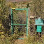
Connects: Highway 82, Roaring Fork River Aspen, CO – Hard – Hike, Dog Friendly – Rocky/Dirt The Airport Ranch Trail a difficult trail network providing fishing access to the Roaring Fork River you can hike that is dog friendly. This…

Connects: Highway 82, Roaring Fork River Aspen, CO – Hard – Hike, Dog Friendly – Rocky/Dirt The Airport Ranch Trail a difficult trail network providing fishing access to the Roaring Fork River you can hike that is dog friendly. This…
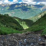
Connects: North Anthracite Trail, Yule Creek Trail, Raspberry Creek Trail Marble, CO – Hard – Hike, Run, Horseback Ride, Dog Friendly – Rocky/Dirt Anthracite Pass Trail #1969 is a difficult trail you can hike, run, and horseback ride that is…
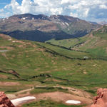
Connects: Maroon Creek Road (CR 13), Maroon Creek Trail, Maroon Lake (9,585 ft), Maroon Bells Scenic Trail, Four Pass Loop, Crater Lake Trail, Crater Lake (10,076 ft), West Maroon Trail, West Maroon Pass (12,465 ft), East Maroon Trail, East Maroon…
Connects: Light Hill, BLM Road 8335, East Sopris Creek Road (CR 7) Old Snowmass, CO – Medium – Hike, Run, Mountain Bike, Horseback Ride, Dog Friendly – Dirt/Rocky BLM Road 8334 is an intermediate/moderate dirt road you can hike, run,…
Connects: Montezuma Basin Road (FSR #102), Castle Peak (14,279 ft), Conundrum Peak (14,040 ft) Ashcroft, CO – Hard – Hike -Rocky The Castle/Conundrum Peak Trail is a difficult trail you can hike to Castle Peak (14,279 ft) and Conundrum Peak…
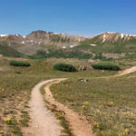
Connects: Independence Pass Road (HWY 82), Independence Pass (12,095 ft), Independence Pass Scenic Trail Aspen, CO – Hard – Hike, Run, Horseback Ride, Dog Friendly – Dirt/Rocky The Continental Divide Trail is a difficult trail you can hike, run, and…
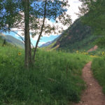
Connects: Castle Creek Road (CR 15), Silver Dollar Pond (10,245 ft), Conundrum Hot Springs (11,230 ft), Triangle Pass Trail, Triangle Pass (12,900 ft) Aspen, CO – Medium – 8.5 Miles – Hike, Run, Horseback Ride, Dog Friendly – Dirt/Rocky Conundrum…
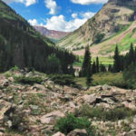
Connects: Maroon Lake (9,585 ft), Maroon Bells Scenic Trail, West Maroon Portal Trail, Four Pass Loop, Maroon-Snowmass Trail, West Maroon Trail, Crater Lake (10,076 ft) Aspen, CO – Medium – 1.8 Miles – Hike, Run, Dog Friendly – Rocky/Dirt Crater…
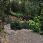
Connects: Gunnison County Road 3, Daniels Hill, Lead King Loop, Schofield Pass Road (FSR #317), Lead King Basin Road (FSR #315), Lizard Lake, Legend of Tall Tree Trail, Crystal Mill, Crystal City (Town of Crystal) Marble, CO – Medium –…
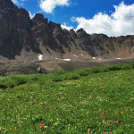
Connects: Cathedral Lake Trail, Cathedral Lake (11,866 ft), Electric Pass (13,494 ft) Aspen, CO – Hard – 5.2 Miles – Hike, Run, Horseback Ride, Dog Friendly – Rocky/Dirt Electric Pass Trail is a difficult trail you can hike, run, and…
Connects: Red Mountain Trail (Jeanne Golay Trail/Red Mountain Road), Cross Trail, Grandstaff Trail Glenwood Springs, CO – Hard – 0.3 Miles – Hike, Run, Mountain Bike, Dog Friendly – Dirt The Fall Line Trail is a difficult trail you can…

Connects: Aspen to Crested Butte, Marble to Crested Butte, Three Pass Loop, Maroon Lake (9,585 ft), Maroon Bells Scenic Trail, Maroon-Snowmass Trail, Crater Lake Trail, Crater Lake (10,076 ft), West Maroon Trail, West Maroon Pass (12,465 ft), Frigid Air Pass…
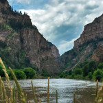
Connects: Glenwood Springs (5,760 ft), Colorado River, Glenwood Canyon Trail, Horseshoe Bend Park, Artist Point (6,540 ft), No Name Rest Area, No Name Trail (Jess Weaver Trail), No Name Canyon, Grizzly Creek Rest Area, Grizzly Creek Trail, Grizzly Creek Canyon,…