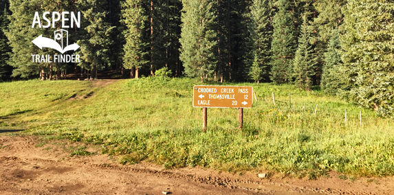
Connects: Eagle-Thomasville Road (FSR #400), Mount Thomas Trail

Crooked Creek Pass (10,009 ft) along Eagle-Thomasville Road (FSR #400)
Thomasville, CO – Mountain Pass
Crooked Creek Pass (10,009 ft) is a mountain pass along Eagle-Thomasville Road (FSR #400) near Basalt, CO.
Distances:
Crooked Creek Pass to Thomasville – 12 Miles
Crooked Creek Pass to Eagle – 20 Miles
More information on Crooked Creek Pass can be found at:
White River National Forest – Crooked Creek Pass / Sylvan Lake


Ugliest place I’ve ever been. You couldn’t drag me back up there. Don’t go it will make you sick.