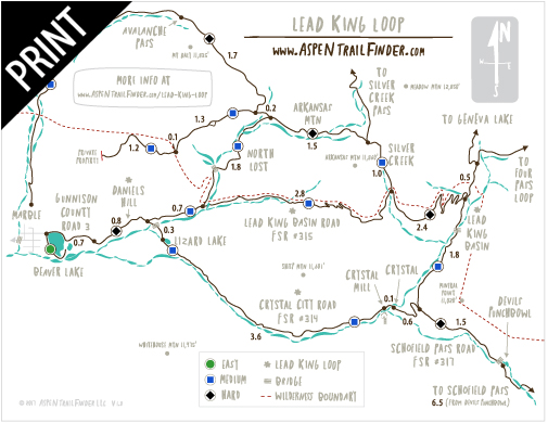
Connects: Gunnison County Road 3, Lead King Loop, Crystal City Road (FSR #314), Lead King Basin Road (FSR #315)
![]()
![]()
![]()
![]()
![]()
Marble, CO – Hard – 0.75 Miles – Hike, Run, Mountain Bike, Dog Friendly – Rocky

Daniels Hill in Marble
![]()
![]()
![]()
![]()
![]()
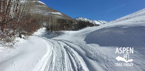
Daniels Hill in Marble
Marble, CO – Medium – 0.75 Miles – Snowshoe, Classic XC Ski, Fat Bike, Dog Friendly – Snow
Daniels Hill is a steep 0.75 mile rocky dirt section of Gunnison County Road 3 past Beaver Lake to the start of the Lead King Loop. The top of Daniels Hill is the intersection of Crystal City Road (FSR #314) and Lead King Basin Road (FSR #315).
Distances:
Beaver Lake to 4 Wheel Drive Only Sign – 0.7 Miles
Mailboxes to Crystal City Road (FSR #314)/Lead King Basin Road (FSR #315) Intersection – 0.75 Miles
More information can be found at:
White River National Forest – Crystal City Road #314 (4WD)
White River National Forest – Lead King Basin Loop Road #315 & #314 (4WD)
Use of the road past Beaver Lake, to Daniels Hill is a privilege, NOT a right!
By permission of the Board of County Commissioners the .7 of a mile of County Road #3 past the Beaver Lake Parking Lot, can be used by you to access public land. Show respect for local residents. Slow down and reduce noise or lost this right!”