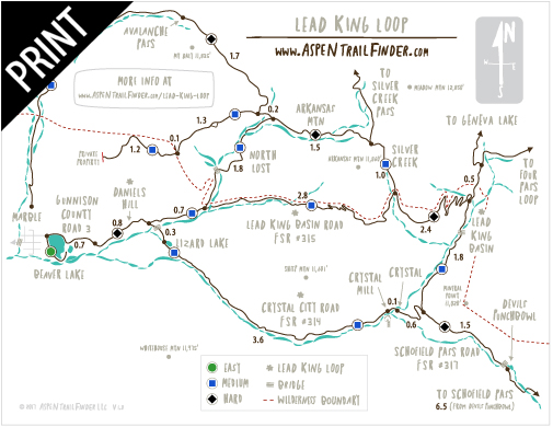
Connects: Lead King Loop, Lead King Basin Road (FSR #315), Crystal City Road (FSR #314), Crystal Bridge No. 4, Devil’s Punchbowl (Schofield Pass), Schofield Park, West Maroon Trail, Schofield Pass (10,700 ft)

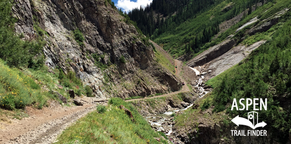
The South Fork Crystal River flowing along Schofield Pass Road (FSR #317)
Marble, CO – Hard – 8 Miles – Hike, Run, Mountain Bike, Dog Friendly – Rocky
Schofield Pass Road (FSR #317), also called the Upper South Fork Crystal River Road, is an extremely difficult road you can hike, run and mountain bike that is dog friendly. This road connects with Gothic Road (FSR #317) that can be used to connect Marble and Crested Butte in the summer. This road is usually closed September-July due to winter conditions.
Distances:
Lead King Basin Road (FSR #315) Intersection to Devil’s Punchbowl (Schofield Pass) – 1.5 Miles
Lead King Basin Road (FSR #315) Intersection to Schofield Pass (10,700 ft) – 8 Miles
West Maroon Trailhead to Schofield Pass (10,700 ft) – 0.8 Miles
News about traveling from Marble to Crested Butte can be found at:
Aspen Daily News (April 30, 2015) – Massive rockslide demolishes road between Marble and Crested Butte
More information about Schofield Pass Road (FSR #317) can be found at:
White River National Forest – Schofield Pass Road #317 (4WD)


 (33 votes, avg: 9.03 out of 10)


