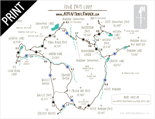
Connects: Aspen to Crested Butte, Four Pass Loop, Crater Lake Trail, Crater Lake (10,076 ft), Maroon-Snowmass Trail, West Maroon Pass (12,465 ft), Fravert Basin Trail, Hasley Basin Trail, Schofield Trail, Schofield Pass Road (FSR #317)

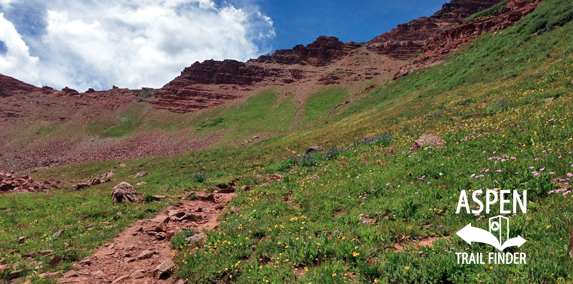
View toward West Maroon Pass on the West Maroon Trail
Aspen, CO – Hard – Hike, Run, Horseback Ride, Dog Friendly – Rocky/Dirt
West Maroon Trail #1970, also called East Fork or West Maroon Pass Trail, is a difficult trail you can hike, run, and horseback ride that is dog friendly. This is a rocky/dirt trail in the Maroon Bells-Snowmass Wilderness that travels over West Maroon Pass (12,465 ft) and is used to get from Aspen to Crested Butte or as a connection on the Four Pass Loop. The section of the trail over West Maroon Pass towards Crested Butte is also called the East Fork Trail.
Distances:
Crater Lake (10,076 ft) to West Maroon Pass (12,465 ft) – 4.75 Miles
West Maroon Pass (12,465 ft) to Hasley Basin Trail – 2 Miles
West Maroon Pass (12,465 ft) to Schofield Trail – 2.7 Miles
West Maroon Pass (12,465 ft) to Schofield Pass Road (FSR #317) – 4 Miles
More information about West Maroon Trail can be found at:
White River National Forest – West Maroon Trail #1970 (Hiking)
White River National Forest – East Fork/West Maroon Pass #1970 (Hiking)
White River National Forest – Crested Butte West Maroon Trail via Schofield Park (Hiking)


 (41 votes, avg: 9.20 out of 10)


